Weird thoughts go through a guy’s head in the midst of 4.5 miles of steady climbing, the switchbacks endless and the intrusive thoughts relentless.
And, boy, the roughly four miles of switchbacks up to the summit of Kendrick Mountain in the Kaibab National Forest certainly gives a guy plenty of time to let his mind wander. The other day, when I wasn’t otherwise dissociating to quell the lung-burning climb, I was thanking the trail builders for providing all the switchbacks, because a steeper, if shorter, climb would have been absolute anathema.
Then, unbidden, the OG hip hop song by Sir Mix-a-Lot, “Baby Got Back,” got stuck in my head. As ear worms go, it could’ve been worse. Could’ve been “Baby Shark” or something. Anyway, my rich fantasy life took over, and I imagined that I became Weird Al and recorded a parody, runners version: “Baby Got Switchbacks.”
I like switchbacks and I cannot lie
You other runners can’t deny
When a trail comes by with an itty bitty singletrack
And big round switchbacks, my lungs get sprung …
Cringe! Yes, I could go on, but I’m self-aware enough to know that no one wants that.
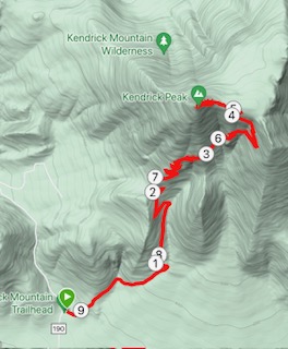
So, what say we talk about the Kendrick Trail, a challenging but entirely runnable 9.1-mile out-and-back (more like up and down) that is a good workout for anyone training for a mountain race (attention: Imogene faithful)?
You gain 2,710 feet in the 4.6 miles from the trailhead to the lookout tower, and you top out at 10,407 feet of elevation gain. OK, it’s not exactly as taxing as Humphreys, but I’ve found it more challenging than other big climbs close to home (O’Leary Peak, Mount Elden Lookout Road, New Heart-to-Sunset-to the tower). Weatherford and Waterline are similar, but those trails are still closed to due fire and flooding and ongoing rebuilding.
Here’s a bonus: Kendrick is not as crowded, even on a summer Sunday, as the above climbs. Maybe that’s because it’s a good half an hour drive north-west of Flagstaff, the last half of it on bumpy forest roads.
Another plus in Kendrick’s favor: It’s got heaps of history.
I first ran Kendrick back in 2019 with the Northern Arizona Trail Runners Assn. (NATRA), whose honcho, Neil Weintraub, was a Kaibab National Forest archeologist at the time and worked on restoring a historic cabin in the meadow just before that last, rocky push up to the lookout tower.

Neil is retired now, but his work lives on in the 1911 Kendrick Mountain Lookout Cabin, which Weintraub and an army of volunteers lovingly restored for several years and which won the Governor’s Heritage Preservation Award.
Stop by and take a look-see; it’ll give your lungs a break and you’ll learn a thing or two about this area’s past.
The first thing Weintraub told us back in 2019 before my maiden voyage up Kendrick was that the first two miles were the hardest.
I respectfully disagreed with Neil then, and I still do.
Sure, it takes a while to get warmed up and in climbing mode, but the first two miles are mostly free of rocks, roots and other technical obstacles that might slow you down. It’s in the final 2.5 miles up when the going gets rougher, fatigue sets in and the possibility of a tumble becomes more than just an abstraction.
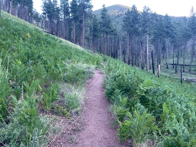
Besides, you can distract yourself during those first few miles by taking in the charred remains of ponderosa pines that denote the lingering effects of the 14,000-plus acre Pumpkin Fire in 2000 that devastated the area.

Regrowth is well underway, with lots of foliage sprouting and aspens dotting the path. Given the fire, there’s surprisingly plenty of patches of shade to keep you cooler on a hot day. The footing is fine, too, with the reddish cinder soil cushioning your feet.
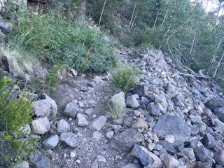
All that will change once the switchbacks really kick in. The geology changes dramatically. Jagged rocks and boulders start cropping up, and the going gets tougher. Then again, the view starts getting better. Back and forth you’ll go, heading northeast and seeing Humphreys Peak in the distance, then south and west and seeing other lava protrusions down below.
The switchbacks eventually subside at the 4-mile mark, when you reach a saddle, treeless yet verdant. That’s when the heat hits. But you know, at this point, that the cabin awaits, then the lookout, then nearly five miles of downhill.
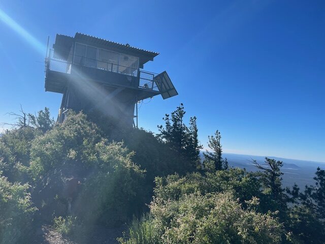
That last stretch to the top is the rockiest section, barely runnable. The good news: It lasts only about 0.5 of a mile. At the tower, unstaffed on this July morning, there are plenty of boulders to rest your weary joints, plus a flat concrete slab to take all the selfies and panorama photos you desire without fear of tumbling down mountain.

The equally relentless downhill spares the lungs but ravages the joints, but it obviously goes by much quicker than the rising switchbacks.
Back in 2019, after the NATRA group and I made the climb and I, personally, was spent, I remember Neil telling us how his restoration crew carried supplies up. I checked my notes, and here’s what I wrote:
(Weintraub) tells us how the volunteers lugged all the materials to restore the cabin up the trail we just ascended. Groans among the runners were audible. It took 16 trips up the mountain, he said. And Dave McKee, who sometimes runs with the group, designed a padded backpack to carry the 8-by-3-foot, 70-pound steel panels that were needed to replace the original roofing.
So, it could be worse. Try climbing all those switchbacks humping steel panels.
On second thought, don’t. Just carrying a water bottle was burdensome enough for me.
Kendrick Mountain Trail
Length: 9.1 miles (to Lookout Tower)
Driving Directions: Head north on Highway 180 for 14 miles outside of Flagstaff. Just past mile marker 230, turn left onto Forest Road 245. At the junction, turn right on FR 171. Continue on FR 171 for about four miles before turning right on FR 190. The trailhead and a dirt parking lot is on your right.
The Route: From the Kendrick Mountain trailhead, follow the path north-east. There are no crosstrails until the very top, when the Pumpkin Trail connects. Stay on the Kendrick Mountain Trail to the top.
Elevation Gain: 2,710 feet.
Highest Elevation: 10,407 feet.


Leave a Reply