It piques the imagination to stand among the remnants and muse about making a life in this challenging landscape …
— Kiosk at Old Caves Crater Trailhead
So ridiculously expensive are current Flagstaff housing prices that, well, living in a lava cave might just be a viable option for first-time buyers.
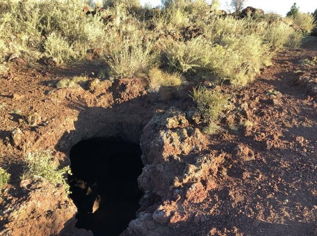
This thought came to me as I crouched into one of the numerous naturally-formed “lava tube” grottoes that dot the apex of a cinder cone of one of Flagstaff’s many wondrous volcanic extrusions. Granted, I was winded at the time and not thinking straight, having just ascended to the summit of the Old Caves Crater Trail, overlooking Doney Park.
But, really, the cave I had entered to catch my breath was fairly nice, as caves go.
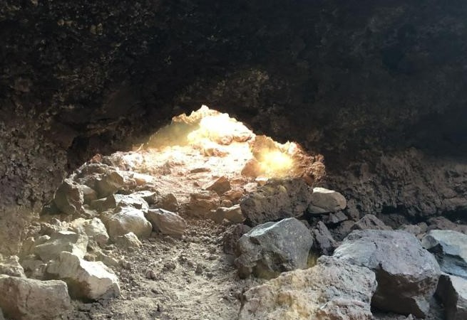
Excellent floor plan, about the size of a walk-in closet. A side room to crawl through that would make a perfect office. The décor, admittedly a bit too beige, was tasteful and understated. Best of all, it faced east, which meant it caught the morning sun to warm and afternoon shadows to keep things cool.
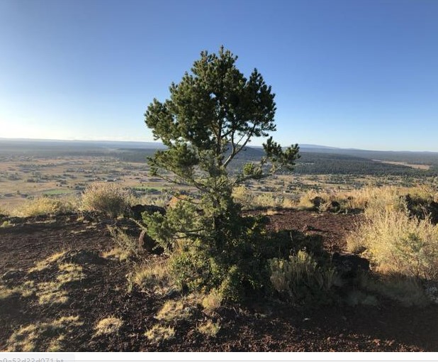
And the views? OMG, Mount Elden and the Peaks to the southwest, O’Leary Peak and Sunset Crater to the northeast, the expansive view of Doney Park all around. Sure, there’s no water source, but you can’t have everything now, can you?
Given the current real estate bubble, I figured a place like this would sell in the low $500,000s. And, better still, no monthly homeowners’ fees — yet. Give the dwellings a fancy name, say, “The Lofts at Old Cave Crater,” and it would sell out pronto, for sure.
I jest, of course. The U.S. Forest Service no doubt would frown upon developing such a geologic wonder, no matter how stressed the housing market gets. But forgive me for extended riff, because the trailhead informational board provided by the Department of Agriculture makes a guy wonder what living in such lofty domiciles was life for the Sinaguan settlers, circa early 14th century.

Archaeologists have determined that, at one time, there were as many as 70 to 80 “rooms” at the pueblo and, down-slope near the cone’s base, they “located what they believe to be the site of a meso-American ‘ball court.’” (What, no Jacuzzi and health club?)
Lava-tube-spotting is only one reason to venture a few miles north of Flagstaff on Highway 89 for a leisurely run at Old Caves Crater.
Both the trails to the summit and the loop around the base of the cinder cone are wide and smooth, made up of crushed volcanic cinder — a welcome break for one’s feet compared to the rocky and root-laden trails on the mountain proper. The footing is almost FUTS-like, except for some sandy sections around the west end of the loop and some rocks along the northern section of the vertically-challenging trail to the summit. The 1.3-mile trek from the trailhead at Silver Saddle Road to the “T” intersection that separates the caves to the south to the summit to the north is a surprisingly pleasant jaunt, considering you gain 540 feet in the process. Rarely are switchbacks so well-manicured and free of obstacles.
As for attractions along the way, you pass through the Fort Valley Experimental Forest area, which provides much-needed shade. The foliage changes as you progress: from Ponderosa pines to pinons to gnarled junipers to scrubby shrubs near the peak. The pebbly black cinder underfoot also morphs into powdery red near the summit, the result of centuries of erosion.
As for running routes, there are only a few options. Most people, interested primarily in the caves or the views from the summit, simply do a 2.8-miles out-and-back. And that’s a fine, invigorating jaunt.
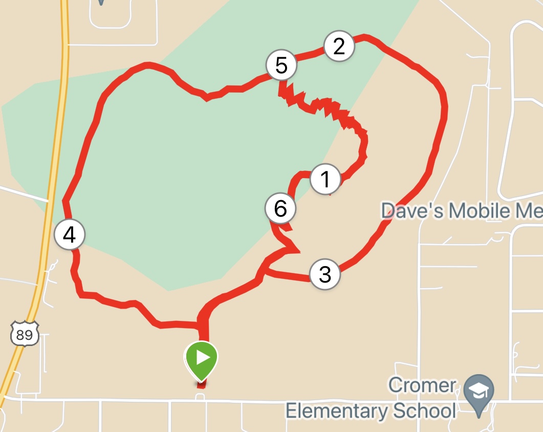
An alternative, though, is to take in all 7 miles of the trail system. I did that by taking the Old Caves Summit Trail from the Silver Saddle trailhead over the summit and down the north side to its intersection with the Loop Trail. (If you keep going straight for another 0.4 of a mile, you will hit the other trailhead, lovingly called Dump Road.)
If you go right, clockwise, on the Loop Trail to the east, you’ll be treated to more pine viewing of a rolling path along the base of the cinder cone. When you hit the intersection with the Old Caves Summit Trail, you turn left and start back toward the trailhead, only to make a right at a sign denoting the West Loop. This 1.5-mile stretch is probably the least bucolic section, running parallel with Highway 89 and passing a few homes along the way.

At the intersection, you have the choice of continuing the loop back or turning sharply right for a multi-switchback climb back up to the summit for a 7-mile total.
I chose the latter option, mainly because I wanted to check out more of the caves. On my second pass through, I spotted an even more spacious living space, complete with a mother-in-law apartment — or short-term rental space, if you prefer — carved out in the back. Never mind the graffiti on that one wall. The place is a fixer-upper and some sweat equity will take care of that.
Old Caves Crater Trail/Loop Trail
Distance: 7 miles (Old Caves Summit Trail, twice, plus Loop Trail); 2.8 miles (Old Caves Trail to summit, out-and-back)
Driving Directions: From Flagstaff, take Highway 89 north to Silver Saddle Road, turn right. Trailhead will be on the left a half-mile east on Silver Saddle.
The Route: From the trailhead, head north of Old Caves Summit Trail, wending through te switchbacks to a “T” intersection. Go right to visit the old caves. Go left to the summit in another 0.3 miles. For the shorter option, retrace steps to the trailhead. For the 7-mile option, descend the north side of the summit trail, turn left (east) on the Loop Trail. Follow the Loop around the base of the cone to the intersection of the Old Caves Trail. Turn left as if returning to the trailhead, but turn right at the sign marked West Loop. Follow that 1.5 miles to the north junction with the Old Caves Summit Trail. Go right to the summit and then down the switchbacks back to the trailhead.
Elevation gain: Short course 520 feet; long course 1,082 feet.


Leave a Reply