Runnable forest roads aren’t hard to find in Flagstaff. But this is winter, and the old favorites – Woody Mountain, Road 700 in Mountainaire, A-1 Mountain – remain in various stages of deep freeze.
So, where to run?
Look east, young man (and woman).
Sure, there are non-snowy trails in Sedona and Camp Verde, but most there are single-track and of varying degrees of technicality. Nothing wrong with that, of course. But sometimes a guy just wants a nice, smooth soft-surface run away from asphalt and traffic.
The answer: Winona.
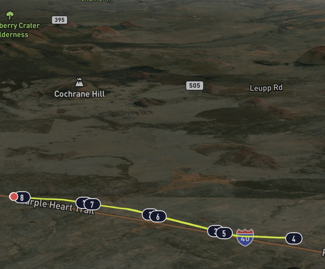
An easy 16-mile drive east in Interstate 40 from downtown Flagstaff, the forest road that runs parallel to I-40 to the south and the railroad tracks to the north provides a venue for a packed dirt run of between 8 and 10 miles (out and back; you can add mileage by veering off on side roads to the north, too). What it lacks in visual is made up for with snow- and ice-free venue with sure footing.
Late fall and winter seems the perfect time to make the trek to Winona. On the morning I made the trip, it was five degrees warmer in Winona than Flagstaff (28 degrees instead of 23, but still …) and not a spot of snow or ice was visible to force shortened strides.
What makes Winona favorable in winter, however, probably makes it far from ideal in summertime. For one thing, there is no shade whatsoever, nary a single tree overhanging the dirt road, officially named County Road 394, though the signage reads Angel Road. So, once the temperature rises (Winona is about 1,000 feet lower in elevation than Flag), there will be no relief from the unforgiving sun.
This time of year, though, it’s almost ideally suited for our purposes.
Most runners who do Winona do not start right after exiting I-40 and heading back across the overpass to the righthand turn to the road in question. That’s because the first mile of CR 394 is crumbly asphalt that is runnable but, really, why bother. Just a mile east, the road turns to hard-packed dirt sans divots. Just beyond the first cattle guard is a pullout where most park and begin the trek.
My goal this morning was an easy, steady-state eight-miler, out and back. The four miles “out” is mostly a slight downhill, with a few blips of curvy uphill to spice things up. The wind was at my back, too, standard issue for Flag (going west to east). The only buzz kill was that I started only after minutes before sunrise, so the big shiny orb was in my eyes most of the way.
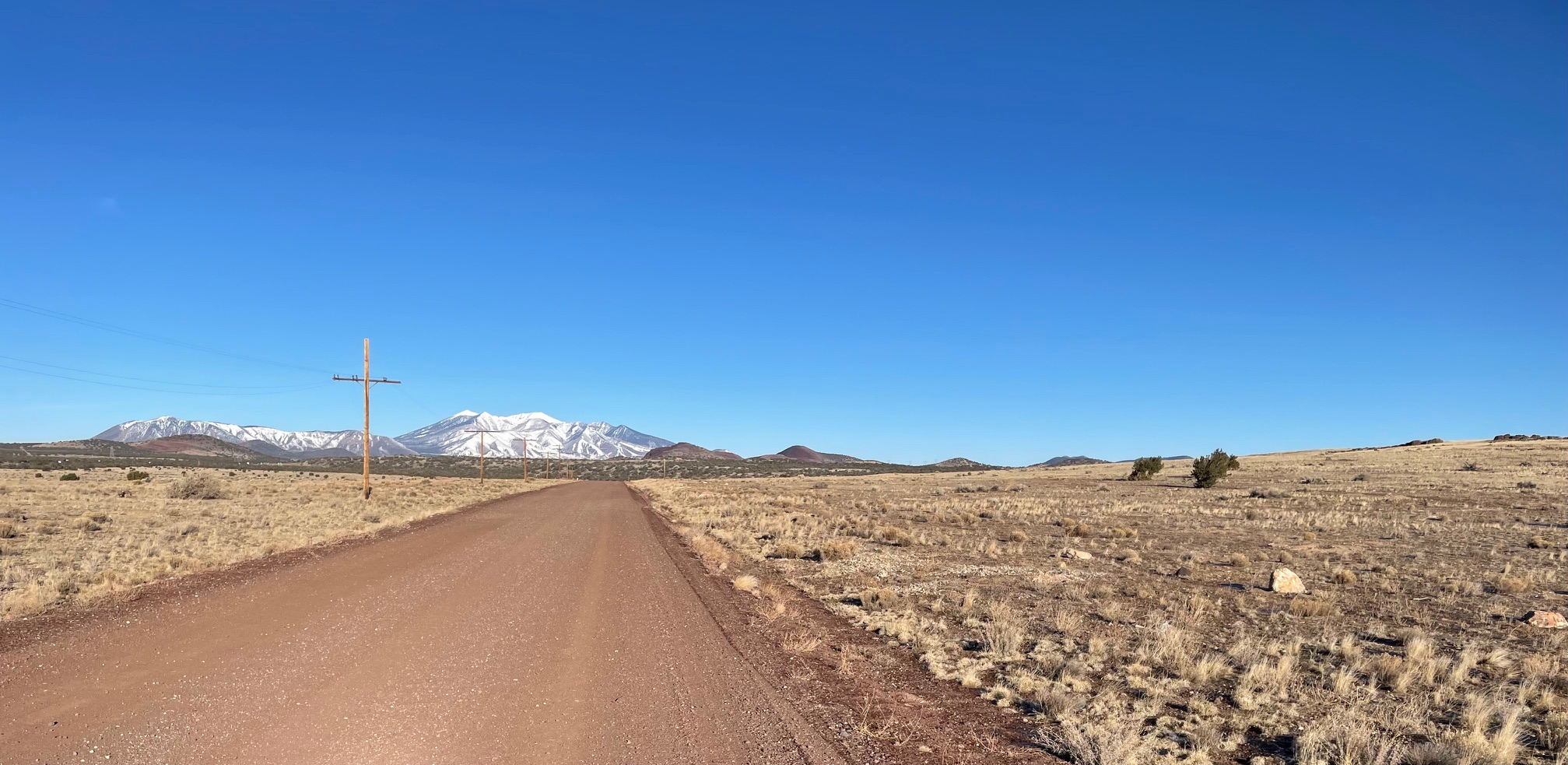
A few words about the dirt surface: Unless my memory deceives, it may be the smoothest forest road I’ve run in Coconino County. That’s a bold statement, but I’ll stand by it. There was none of the washboard undulations that often mar Woody Mountain Road and make runners alter their strides. Nor were there dried over muddy ruts from cars barreling through, as at A-1 Mountain. Jutting rocks and the occasional boulder, as at Road 700? Nope. The only rocks on this path could almost be described as overgrown pebbles.
Given my advancing senescence, it takes me a mile or so to get my legs lubricated enough to hit stride, so I welcomed the 60-foot drop in Mile 1. It flattens out thereafter and you can get in a groove on the oh-so-slight downhill for the next three miles.
Now for the not-so-great news. The run, frankly, is kind of boring. I eschew ear buds and don’t listen to music, preferring a more meditative state and body-awareness. But a lulling cello sonata, or a gnashing grunge power chord progression, might have made the miles go faster.
I tried to commune with nature; really, I did. Tried to make it a sensory experience. Was that sage I smelled? Is that a squirrel carcass up ahead or a discarded glove? Instead, my auditory senses took over. I timed my pace to the drone of the trucks blowing by on I-40 to the south and waited for the lonesome whistle from another BNSF train headed west. The only hint of wildlife, other than the dead squirrel, was a lone coyote loping across the road at Mile 3.
After the four-mile turn-around, the way back presented a bit more of a challenge. That’s when you gain most of the 262 feet of elevation. So there’s that. I also started playing games with the squat telephone poles that stretched for more than a mile in the middle of the run. Essentially, I did fartleks – surge for two poles, back off for two, repeat. That made the miles go by faster. Plus, you get a view of the San Francisco Peaks and Mount Elden on the way back, though the headwind was kind of a bummer.
I didn’t fully appreciate my Winona effort until I was driving back on I-40 and looked south down at the FUTS just before Lone Tree and saw that the Sinclair Wash Trail was still covered in snow.
Winona: CR 394
Length: 8 miles (can be lengthened or shortened)
Elevation Gain: 262 feet.
Directions: From the conjunction of I-17 and i-40 in Flagstaff, head east on I-40 for 16 miles to the Winona Exit. Turn left and head back over the freeway. Make the first, sharp right onto Angel Road (also CR 394), which runs parallel to the freeway. Drive 1.1 miles east on the decaying asphalt road and park at a pullout just past a cattle guard and the start of the dirt road.


Leave a Reply