I remember, vividly, the first time I made the lung-searing 4.5 run to the top of Mount Wilson in Sedona. It was four years ago, and I just getting used to the trails around Flagstaff and Sedona, still trying to shed my identity as a suburbanite who previously lived in a town, Davis, Calif., where the biggest elevation gain was a freeway overpass.
So, I arrived at the trailhead, Midgely Bridge, right off Highway 89A. There, I was greeted by a rather ominous sign. It read: “Richard Wilson was an old bear hunter who lived at Indian Gardens. In 1885 he was killed by a large grizzly bear in what is now known as Wilson Canyon.”
Gee, have a good run.
OK, so I was smart enough to realize that grizzly bears have long since vamoosed from Arizona (though last winter, I did see a cute brown bear on the Upper Oldham Trail in Flag). So, no ursine danger was imminent. The real danger was hypoxia (yeah, I exaggerate), since the trail does climb to the highest point in Sedona and affords gorgeous views.
Ascending Mount Wilson is popular activity in Sedona, and hiking/running tourists get a certain smug satisfaction out of accomplishing the task – so much more prestigious than Devil’s Bridge, Bell Rock or any of the woo-woo vortexes in town. In fact, the Instagram group @thefittestofflagstaff recently chose Wilson as its latest monthly fitness challenge.
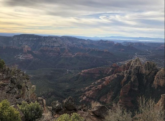
The thought of the Man vs. Grizzly encounter dogged me all the way to the summit — which, by the way, is a killer to get to but affords gorgeous views of all of Sedona to the south and, along the way, a peek at Humphreys Peak to the north. Knowing that I may not be the only one curious to learn the backstory, I did some digging.
A hat tip to the Verde Independent for the historical details. Let’s keep this brief, though, since most people probably want to know about the vagaries of the trail itself, not its namesake.
OK, so it turns out, Richard Wilson was this grisly old-timer — employed by Sedona land baron Jim Thompson — who had an unhealthy thing for grizzly bears. Loved to stalk ‘em and hunt ‘em down. It was his passion and also his fatal flaw.
On the way to what is now Sedona to keep an eye on Thompson’s family in the patriarch’s absence, Wilson saw grizzly tracks. Though he possessed only a small caliber rifle — his big-game gun was being repaired — Wilson couldn’t help himself. He tracked down the bear and shot it several times. The wounded bear retreated up the canyon, about where Midgely Bridge is today, with Wilson in hot pursuit. The bear then turned and charged.
Nine days later, searchers found Wilson’s body. Not to be too graphic, but his face had been chewed off. Fifteen years later, someone found the skeletal remains of a large grizzly atop the mountain, with Wilson’s knife embedded in its side.
So, I ask, was Wilson’s act of either hubris or stupidity reason enough to name Sedona’s highest peak — not to mention the beautiful canyon besides Oak Creek — after the doomed hunter?
I’ll let you chew on that philosophical conundrum, while I tell you about the challenging but fulfilling 9-mile trek (out-and-back) on the Wilson Mountain Trail.
Sedona, unlike Flagstaff, is not known for its epic climbs. Certainly, there are scores of trails to test your climbing acumen, but no real long march straight up to a summit other than Wilson Mountain. (OK, maybe the A.B. Young Trail, too.)
That’s why it’s so popular among locals, who in winter and even now would need crampons and an ice axe to scale Humphreys Peak but can summit Wilson encountering snow only in the very last, 7,000-foot-plus push to the top. And tourists find it popular because its payoff is a panoramic view of the entire Sedona valley, those reds and greens framed by the blue sky so dazzling on their Instagram feeds.

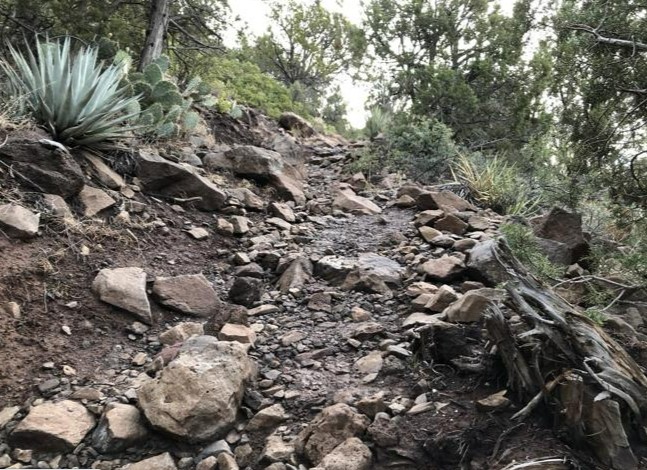
But the Wilson Mountain Trail is not easy. You need decent lung capacity and good balance to deal with the intense verticality and rocky, technical footing — especially in the winter when the trail is slick and tacky with rainwater. In summer months, there’s also the matter of excessive heat, because a serious lack of shade exists due to a 2006 fire that wiped out many of the Ponderosa pines that dotted the upper reaches.
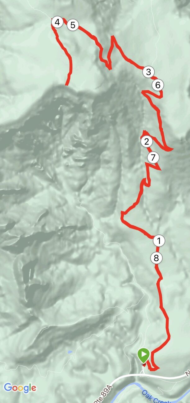
There are two trailheads from which to choose, two paths, but both are steep. The more popular — read, slightly easier — is to start from Midgely Bridge, where it’s about a 3-mile climb to the First Bench. You also could start a few miles north at the Encinoso Picnic Area and take the North Wilson spur up to First Bench. It’s slightly shorter, but also slightly steeper.
Heading off from Midgely, you start climbing immediately. No easing into it. In the first 06. of a mile, when you hit the Red Rock Wilderness sign, you already have passed by gnarled manzanita jutting from the red-rock soil and patches of cacti that reminds you that you are desert-dwelling. Near First bench, the boulders slightly obscure the path and you’ll do some hands-on-knees scaling of big slabs. You cross several ravines that provide a dizzying look at the canyons below. And, throughout the trek, the distant (and not-so) red-rock formations are ever-present.
Fortunately, the footing gets better after First Bench for the final 1.5-mile push to the summit and the Sedona overlook. Unfortunately, the climbing doesn’t slacken. It is on this final section where you see the charred remains of the 2006 Brins Fire, which leveled many a Ponderosa pine.
Only one clump of pines remains, and it’s near the top. When you finally reach the stand, it feels as if you’re back traversing a Flagstaff trail. It’s smoother and loamy, a delightful change from the rock gardens below. Atop the overlook, though, the blackened branches and stumps resume.
But don’t let that detract from the views showing all of the valley, including way down below, the tiny speck that is Midgely Bridge, where you started your journey and where poor old Richard Wilson ended his.
Wilson Mountain Trail, Sedona
Distance: 9 miles (out and back)
Directions to Trailhead: From Flagstaff, drive 22 miles south on U. S. 89A. The trailhead is just north of Midgley Bridge where you’ll find a small parking lot. A $7 Red Rock Pass can be purchased from a kiosk.
The Route: From the Midgely Bridge parking area, take the trail north-east uphill on the signed Wilson Mountain Trail. Continue on the trail for 4.5 miles to the top. At First Bench (3 miles), continue straight at the intersection with the North Wilson Trail. At 4 miles, veer left to go to the Sedona Overlook (another 0.5. miles) of continue another 1.5 miles on the Wilson Mountain Trail to the north overlook. Retrace steps back to the trailhead.
Elevation Gain: 2,591 feet
Maximum Elevation: 7,052 feet


Leave a Reply