Those who enjoy running on the trails on Mars Hill/Observatory Mesa – both the FUTS and the forest roads – may want to head down to the Flagstaff Coconino Main Library Thursday (5 to 7 p.m.) for a presentation and user feedback on the final plans for the Greater Observatory Mesa Travel Plan.
Read the proposed final plan here. There’s a survey, too, to fill out.
OK, so you have neither the time nor inclination to pore over a 65-page document. Understood.
You are probably wondering, though, how this affects trail runners and our user experience.
I have read the 65-page document (I know, get a life), and I am mostly encouraged by the changes. In sum, some unauthorized “social” trails will be closed but many more trails and roads will be built or improved. Plus, there will be two new trailheads established on the south-west side.
Full disclosure, I live abutting Observatory Mesa (near the Tunnel Springs trailhead), so this is a subject that piques my interest.
Observatory Mesa is a tricky logistical puzzle for trail builders and administrative officials, because the land ownership is split between three entities: the City of Flagstaff, the U.S., Forest Service and Lowell Observatory. Plus, there are other stakeholders, such as environmental groups and private home owners.
So, it’s complicated. I suggest you attend the meeting to hear people out and add your own comments.
Below are some of the highlights (from my perspective) of the final plan:
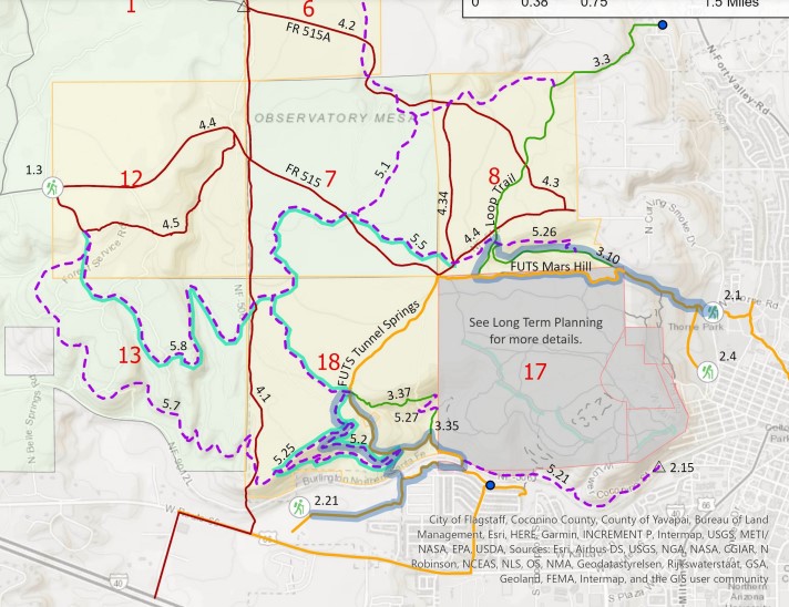
- The two new trailheads will help solve the problem of users parking in neighborhoods next to the FUTS. One trailhead will be at the west side of the City Maintenance Yard, which will connect to the FUTS and leads to the big, nasty hill going up Tunnel Springs. The other trailhead will be on Forest Road 515 up on the far west side of the mesa. This is accessed from taking the A-1 Road exit off Interstate 40 and driving north uphill. (People already park there. This will make it official.) At least at the Maintenance Yard/Route 66 trailhead, there’s supposed to be kiosks and bathrooms.
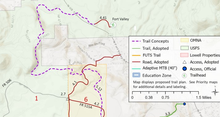
- There will be an authorized Fort Valley Connector on the north-west side, which will link the two popular trail systems. The starting point, the report states, will be at Hidden Hollow Road.
- There will be a new singletrack trail that will connect the Tunnel Springs FUTS trail to the Lower Coconino Street Road running parallel to the railroad tracks, which will discourage users (like me) from running on the service road next to the tracks. That’s pending approval of some private land owners, apparently.
- That rocky portion of the Loop Trail that starts at an intersection with the Mars Hill Trail and runs down into the neighborhoods near Fort Valley and Highway 180 will be smoothed over. Some of my DNA (skin, blood) remains on those rocks.
- Some existing “social” trail will become official and improved for multi-use, including several loops specifically for hikers/runners south-west of the Tunnel Springs FUTS.
- There will be two new and/or renovated trails designed for mountain bikers (berms, high curves, etc.) but still open to all users. The report states the trails will be “designed to provide a beginner and intermediate level difficulty. These features will not impede the walkability of the trail, and signage will be included in the trail system to set expectations and alert mountain bikers and non-mountain bikers to the presence of each other.”
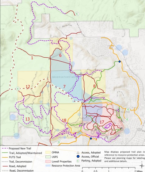
- About adopting those social trails, the report states: “… the construction of 10 segments of new trail that further increase connectivity and provide additional experiences for trail users. The total mileage of adopted unauthorized trails into the system is 1.53 miles (not including long-term planning elements), and the total mileage of new trail construction is 18.43 miles. This will increase the trail mileage of the system from its current 5.27 miles to a new total of 25.23 miles on OMNA and Forest Service lands.”
There’s more, folks, much more. For instance, there the whole issue of how Lowell plans to develop part of its land, but that’s an issue for another day.
Here are some maps that might help:


Leave a Reply