One of my few running regrets during my five years in Flagstaff is that I was never able to participate in the Soulstice Mountain Trail Run on its original hilly and challenging course, the famous trails around Schultz Pass.
In 2019, I moved here too late to register for the lottery. In 2020, well, Covid. In 2021, I can’t remember what I was doing that Saturday in October, but it must’ve been important. And in 2022, the Pipeline Fire and subsequent flooding closed most of the trails comprising the course, forcing volunteer race director Neil Weintraub to move the iconic race to its new home in Parks.
Rather than lament the loss of the original course – yes, most of the trails around Schultz Pass have re-opened, but the race has stayed in Parks for a ton of technical issues the layperson cannot imagine — what say we celebrate the subtle but sublime aspects of the new course?
This year’s Oct. 12 race has long since sold out, but Weintraub, through his (also volunteer) role as leader of the Northern Arizona Trail Runners Assn., arranged a preview run of the course last Saturday. It was the final seven-mile loop that makes up the bulk the course, where the race can be won or lost.
But, first, some words about the vibe of Parks and the wide-open spaces that feed the soul of the new Soulstice.
OK, to be honest, gone are the towering ponderosa pines, stately aspens and quad-building hills, but that doesn’t mean the Parks course lacks aesthetics.
Far from it. It’s just a different type of natural beauty, featuring vistas of the peaks that loom in the distance (Kendrick, Sitgreaves, San Francisco, Bill Williams) and a few modest hills that add some topographical spice to the flat prairie terrain.
The main vibe I felt was a freeing sense of openness in what otherwise can be a claustrophobic trail scene in the greater Flagstaff environs. The Sunset Trail, say, or the Weatherford – part of the original course – can be confining on race day and, especially, just on a regular old weekend when mountain bikers take over.
But Parks? Nope, not much going on. Even on a Saturday, only a few pickup trucks blew by on the main dirt road (Government Prairie/FR 107), and Weintraub expressed mild surprise that it was “that crowded.” It’s a run for those who crave solitude – or for those who want to run with a few friends four-wide on the forest roads without having to yield much, if at all.
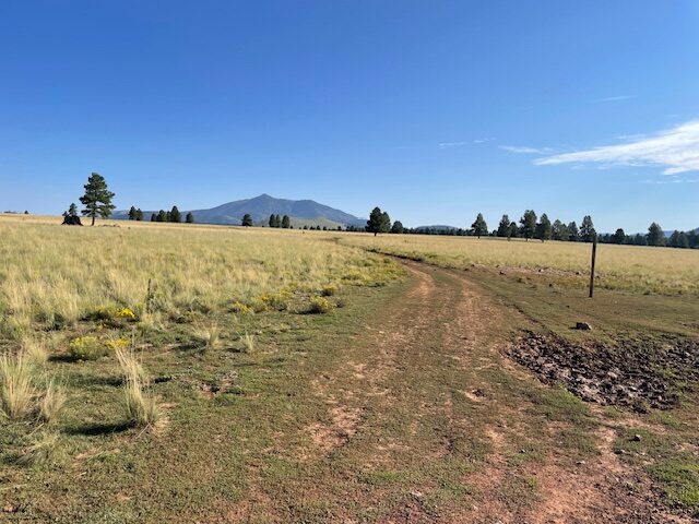
Plus, Weintraub reports that the widely-spaced residents of Parks don’t much mind having their exurb invaded once a year and, in fact, they come out and support the Soulstice runners.
The second “big loop” that makes up the last seven miles of the course features barely 200 feet in elevation gain and you never get higher than 7,492 feet. This makes for quick times, and that’s been reflected in the last two Soulstice races.
It’s not too technical, either, with wide, mostly smooth forest roads for the first two miles, Government Prairie and the first part (east-bound) of FR 81. On race day, this is where many runners start to open it up and let it fly. The third mile of the loop is a bit rockier and, of course, I found a jutting rock over which to trip.
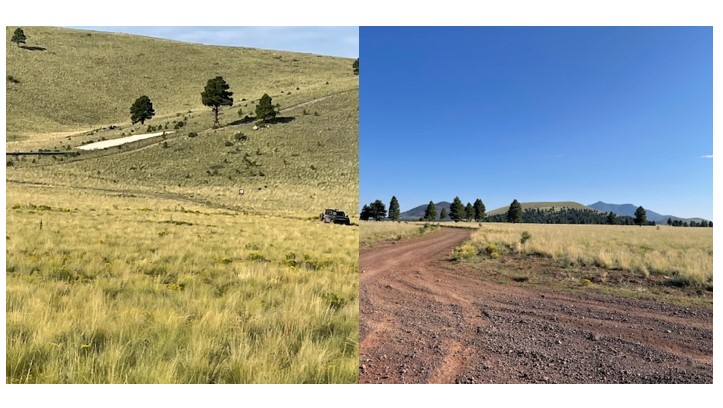
As you’re heading north on FR 81, you’ll reach a junction on the right for FR 156 heading north-east to the Lava River Cave. Avoid making that mistake and stay north on 81 as it leisurely makes its way around the hill, which looks much bigger the closer you get to its north side. It’s officially called Government Prairie Vent; more on the history behind that extrusion below.
On this day, it was a tad unsettling having a pass a group of camo-clad target shooters on the side of the hill but, thank goodness, these folks had decent aim. Just before the fourth mile of the loop, you veer left onto FRR 793 for a about a quarter of a mile, before turning left and rejoining Government Prairie back to the start (or, on race day, the finish line).
It’s almost embarrassing to say this, but there is a slight – oh so slight! – rise (I wouldn’t deign to call it a hill) on the trip back. But in the latter stages of a swift race like Soulstice, runners might feel it a bit.
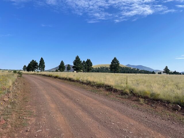
When you finish this part of the Soulstice course, you think to yourself, Hey, why don’t I come out to Parks more often; it’s so peaceful out here. But its distance from Flagstaff (roughly, 18 miles) and its lack of hills for those who crave Vert precludes many from mustering the will to make the trek.
Their loss. Soulstice has made itself quite comfortable in Parks and is starting a new traditional in these parts.
Oh, and about the volcanic “hill” you run around. Weintraub passed along the geological history, courtesy of NAU professor emeritus Michael Ort, a 15-time Soulstice finisher:
“That is the famous Government Prairie vent, one I’ve taken students to for years and also lead official field trips to. It is a benmoreite (like a high-Na basalt) scoria cone that had a lava flow that carried off part of the cone to the east, making the big lava plain to the east and leaving an amphitheater. BUT, the really cool thing is that the ascending magma must have intersected a pod of magma that had been slowly cooling in the crust, one that melted crust around it and also crystalized so that it evolved to being a rhyolite (about as high silica as a magma can be, like some flows on Kendrick or San Francisco Mountain). This is very thick sticky viscous magma. Having been heated and having its ascent pathway greased by the benmoreite, it ascended and made a dome in the middle of the breached crater and a lava flow punched out of the side of the cinder cone just about facing where the race will start. This is pretty much a unique volcano – several others in the field have rhyolite plugs in their craters, but I don’t know any that also had the flow punch out of the side of the cone too.”
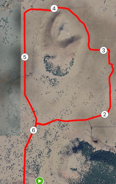
Soulstice Run 7-Mile Loop, Parks
Driving directions: From Flagstaff, take Interstate 40 for about 19 miles to the Parks exit. Turn right (north) off the freeway, then make a right at Old Route 66 (the first right), which turns into Brannigan Park Road. Make a left on Government Prairie and go about three miles. You can park on the roadside shoulder to begin your run.
The Route: Run north on Government Prairie/FR 107. Turn right at the first major intersection, FR 81. Take FR 81 for about a mile and make a left at the second intersection, the continuation of FR 81. (If you continue straight, it becomes FR 81B.) Continue on FR 81 as it loops around the hill on the left (west). When 81 ends, veer left for a quarter mile on FR 793 and then veer left again to return to Government Prairie. Take that back to the start.
Elevation gain: 202 feet.

Leave a Reply