My daughter, a much more intelligent and entertaining version of me, has this quirky habit. Whenever she trips, even slightly, on a rock on a trail run, she takes it out on the rock. Not physically – at least, in most cases. But she gives the rock a good talking to, replete with colorful profanity.
If my daughter ever ran on the Rocky Moto Trail in the foothills of the San Francisco Peaks, no doubt she’d be swearing like a sailor.
I, too, trip a lot of the trails. But I only berate myself, not inanimate objects.
If there is a single jagged rock jutting up on a dusty path, my feet will somehow find it. If there’s an exposed root, a lone gnarled bit of bark running across a trail, I will trip over it. And if there’s a steep and twisting downhill, no matter how well-groomed the trail might be, there’s a decent chance I will face-plant at some juncture.
Call me a trail-running klutz, despite decades of experience on what experts like to call “technical” trails, ones replete with rock gardens and steep descents and other hazards that might draw blood and leave scars.
So why would I even think of doing a run on the single-track that begins at Snowbowl Road — the Rocky Moto Trail?
Because I may not be the sharpest rock on the trail, that’s why. Now, if I didn’t have a masochistic streak, I would have seen that R-word, “rocky,” and looked for another option.
That’s especially true, considering that Rocky Moto is open to motorcycles and e-bikes, anathema to trail-running purists. But something in my knotted psyche makes me seek out quasi-challenging trails, and my experience traversing other motorized trails taught me that you can get in a morning run before the motorcyclists even wake up, let alone rev up.
My plan was to complete an 11-mile semi-loop starting at the western terminus of the Rocky Moto Trail, making a northern turn onto the switchback-laden uphill of a portion of the Secret Trail, then descending on the Moto (sans rocks, or so I presumed) Trail, then cruising for about 3 miles back to the trailhead along the Arizona Trail (34A), which runs parallel to Rocky Moto before intersecting with it.
Because I am a lifelong flatlander trying to acclimate to high-elevation living — working on the gradual-turning-up-the-heat-in-the-lobster-pot premise — I was drawn to this route because the high point would be only 8,400 feet, easily runnable.
The easiest way to start the loop is to park at the lot on the corner of Highway 180 and Snow Bowl Road, then trod on the asphalt (heresy, I know) for two tenths of a mile until you hit Forest Road 164B.
It’s a short connector to Rocky Moto and hardly rocky at all; rather, it’s a dusty, flat path slightly less than a half a mile. In fact, even after you make the right turn onto the Rocky Moto Trail proper, it’s not treacherous as you ramble to the junction with the Arizona Trail about a mile into it.
Pshaw, I’m thinking. This is nothing. Not even the slightest stumble so far.
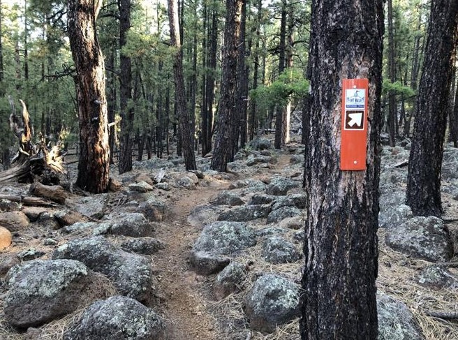
Stopping at the junction of the Rocky Moto and Arizona trails, you can start to see differences in terrain. To the right, the Arizona Trail is a flatter and smoother singletrack, not exactly the crushed granite you’ll find on the FUTS, but gentler. To the left, on the Rocky Moto, rocks are strewn. Most, granted, are smoothed over from erosion and bike tires, but they are omnipresent.
Well, I asked for it, so I plunged ahead on Rocky Moto. I reminded myself of a trail runner’s advice to lift one’s knees, especially on the trailing leg, to avoid tripping and to always look about four feet ahead on the trail to prepare for any major extrusions. So as Rocky Moto progressed with turns every 10 feet or so, my shoes’ rock plates absorbed major boulder scuffing.
But I was torn between keeping an eye on the ground beneath my feet and looking up to enjoy the tall pines and grassy meadow with lupine in bloom. Two miles in, the rocks got more plentiful, anchored on each side by large (5-feet tall and wide) boulders with lichen clinging like barnacles.
And then it happened: my first ankle-roll. But I stayed upright, hopping a bit as the pain subsides. I make it through Rocky Moto without further incident and make a left turn onto the Secret Trail for a 2.2-mile stretch that includes switchbacks and climbing. It is the highlight of the run: trees, boulders, lush vegetation and relatively rock-free footing. I wondered why it’s called the “Secret” Trail, though, because the imprints of bike tires and shoe soles attests to its popularity.
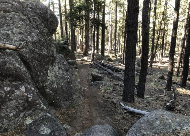
You’re almost sad to leave the Secret Trail at the junction with the Moto Trail (what regulars call the “upper” Moto). It’s a steep 1.5-mile downhill with hairpin turns and lots of boulder hopping. Another ankle roll happened on this steep descent, but I stayed upright throughout.
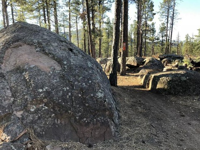
By the time the trail flattened and reached its junction with the Arizona Trail, I figured this will be one of the few quasi-technical runs in which I do not draw blood. My presumption turned out to be my downfall — a literal fall. You are tempted to pick up the pace and lengthen your stride heading back, after the choppy, slow going on the Moto descent. That’s what I did and, just like that, down I went.
Bloody hands and elbow. Nothing major. Merely flesh wounds.
Fortunately, I have good insurance, and I’ve already reached my deductible.
Rocky Moto Trail Loop
Length: 11 miles
Elevation gain: 1,124 feet
Maximum elevation: 8,401 feet
Trailhead parking: Park in the lot at the corner of Highway 180 and Snow Bowl Road.
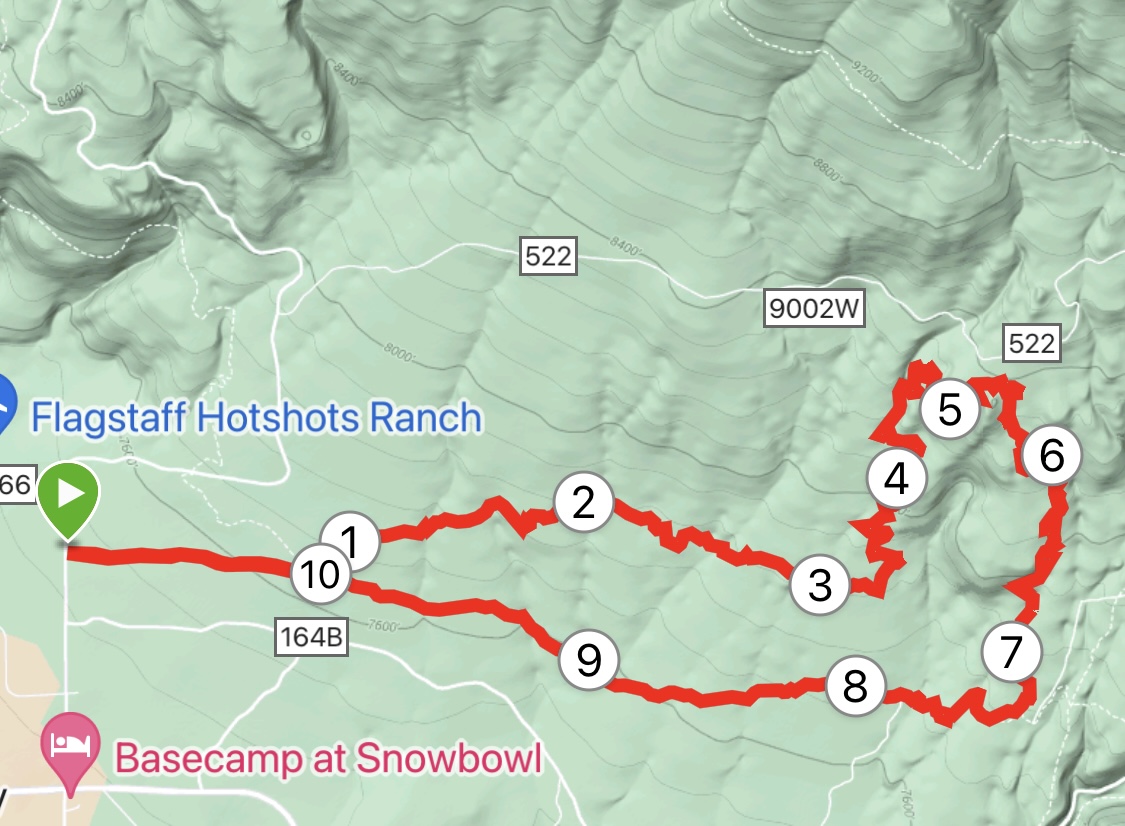
The route: Run north on Snow Bowl Road for two-tenths of a mile to FR 164B. Take a half-mile connector trail north to the Rocky Moto Trail. Turn right on to Rocky Moto, then left to stay on Rocky Moto at the junction with the Arizona Trail. At 3.5 miles in, turn left for the Secret Trail. Go 2.2 miles to the junction with the Moto Trail. Take a sharp right onto the Moto and go downhill 1.5 miles to the junction with the Arizona Trail. Go right for close to 3 miles to meet the Rocky Moto Trail. Retrace steps to the parking lot.

Leave a Reply