Excuse me, I need to go lie down. I thought I had recovered enough from running up Bill Williams Mountain to write about it.
…
…
…
OK, I think I’ve regained enough strength now in my geriatric corpus.
It’s not so much that ascending the 3.8-mile trail from the Williams District Ranger Station of the Kaibab National Forest to the 1930s-era lookout tower is so enervating on its own. Humphreys and even Kendrick peaks are tougher climbs.
I guess what makes me so tired by the end of the 7.7-mile roundtrip up Williams is that I don’t expect it to be a challenge. It’s weird, I know. I’ve done this run three times now, and I am fully aware that it’s a 2,503-foot elevation gain in less than four miles and that it tops out at 9,243 feet.
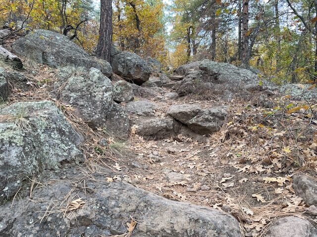
But it seems I have some sort of hypoxic-induced amnesia when it comes to this trail. I keep thinking I can run up the mountain with a sustained, hard effort, conveniently forgetting that the trail is technical – think, large boulders, exposed roots – and that there are hardly any switchbacks to lessen the climbing impact until the final push.
So, all three times, I’ve felt spent at the end.
But not regretful for making the effort.
Bill Williams Mountain is a fine uphill trail to add to a trail runner’s arsenal. It’s technical and primarily singletrack, a la Humphreys and Mount Elden Lookout (the trail, not the road), it’s steep like Kendrick and O’Leary Peak, and not as a far a drive as climbing out of the Grand Canyon.
Plus, it’s freeway close, about a mile off the main Interstate 40 Williams exit, a scant 29 miles from Flagstaff.
And there’s this: the trail is exceedingly well marked, not surprising since the trailhead is right at the Williams District Ranger Station (don’t forget to visit the Smokey Bear statue out front).
Green diamond-shaped blazes are affixed the trees at various points but, really, they aren’t needed. It’s a straight shot — well, except for the serpentine switchbacks — on the main trail. It’s nearly impossible to get lost, since the three trails that intersect are clearly marked, as well.
The only tricky part comes near the top, when the Williams Mountain Trail (numerically dubbed 21, for the record) ends at a fire road. Just crane your neck up and spot the lookout and radio towers and follow the road as it winds its way to the end.

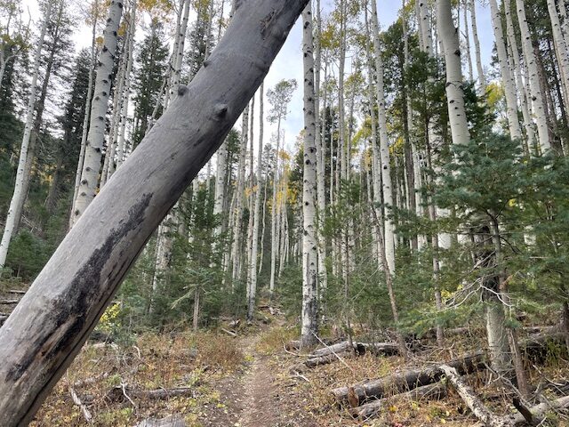
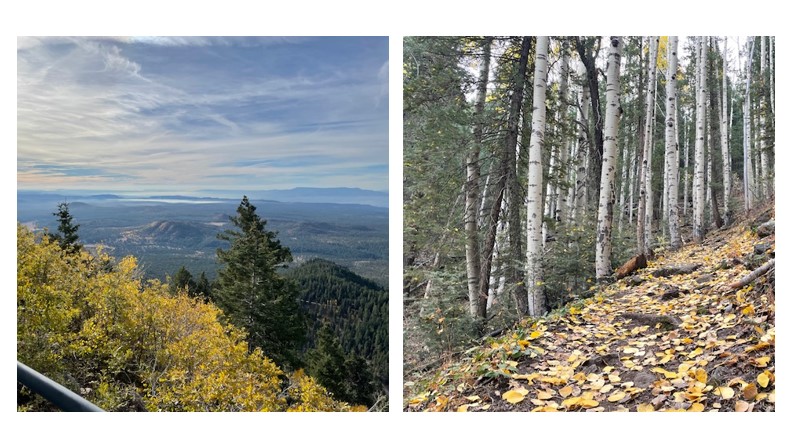
What will you see along the way? Lots of trees, both standing regally and strewn across the slopes like that old children’s game of pick-up-sticks. What’s striking, though, is the arboristic variety. There are stands of oak, alligator juniper (looking sickly here, as in other Arizona locales), spruce, aspen, Douglas fir and the signature ponderosa pines.
The fields of aspen higher up may have lost part of their glorious golden hue when I ran in late October, but they still shined.
Yet another plus: I had the trail to myself on a Sunday morning — at least on the trip up. Alone with my thoughts, I let my mind wander to the cursory research I had done about what, if any, relationship the preacher-turned-trapper-turned dictionary editor-turned-mountain man Bill Williams had with the mountain and town bearing his name.
There is, far as I could tell, no evidence that Bill Williams (nickname: “Old Solitaire”) ever stepped foot on the mountain or the flatlands that honors him. In fact, the mountain itself was originally home to the Hopi, but 19th century name-givers chose to ignore that and instead commemorated the red-headed fur trapper who was killed by the Utes in southern Colorado in 1849.

Still, I was trying to channel “Old Solitaire” on my solo run, but, on the return trip down the mountain, I ran into four groups of hikers at various points – all with big dogs off-leash and barreling right at me.
“Oh, they’re friendly,” the hikers all yelled to me, as if rehearsed. But I had, each time, to pick up my pace on a steep downhill and veer off the singletrack to avoid a canine confrontation.
Maybe that’s why I was panting like a dog by the end of the run.
Bill Williams Mountain Trail
Distance: 7.7 miles (round trip, out-and-back)
Driving Directions: From Flagstaff, head west on Interstate 40 toward Williams. Take Exit 161, go back over the freeway on Route 66 and make a sharp right on Frontage Road. Go 0.5 of a mile and turn left at the sign for the Williams District Ranger Station. Trailhead is located just east of the Ranger office. Parking is free.
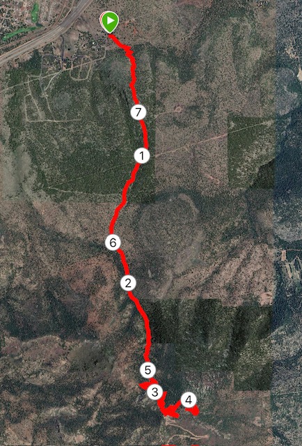
The Route: From the trailhead, take Bill Williams Mountain Trail (#21) 3.8 miles to the lookout tower. Follow the green diamond-shaped blazes affixed to trees to stay on the singletrack path. The last quarter mile is a forest road curving to the summit.
Elevation gain: 2,503 feet
Highest Elevation: 9,243 feet


Leave a Reply