Back in an earlier incarnation of my work life, the summer of 2020, I wrote about a nice, short, out-of-the-way trail in Williams – Davenport Hill – and the story caused a little controversy.
What? A trail report that stirred up the populace?
Apparently so. These days, even something as seemingly innocuous as a trail feature can become political. Sigh.
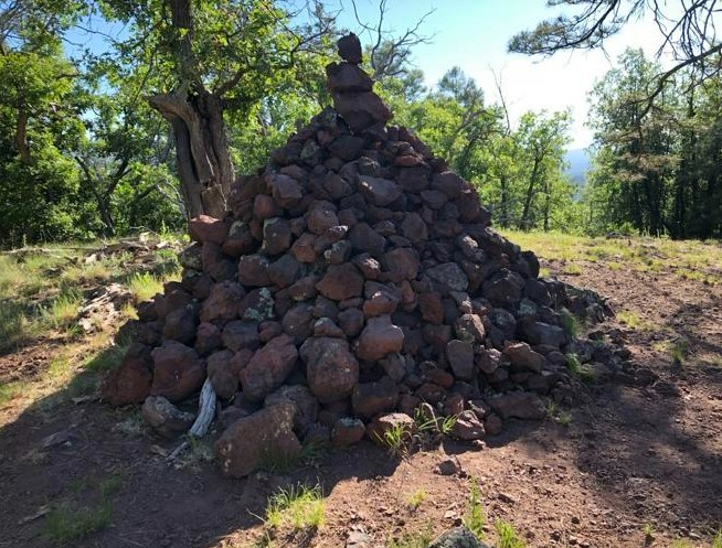
It all entailed what I found when I reached the summit of Davenport Hill, a 5.5-mile out-and-back trail abutting Dogtown Lake in Williams. There, looming over the landscape, was a cairn.
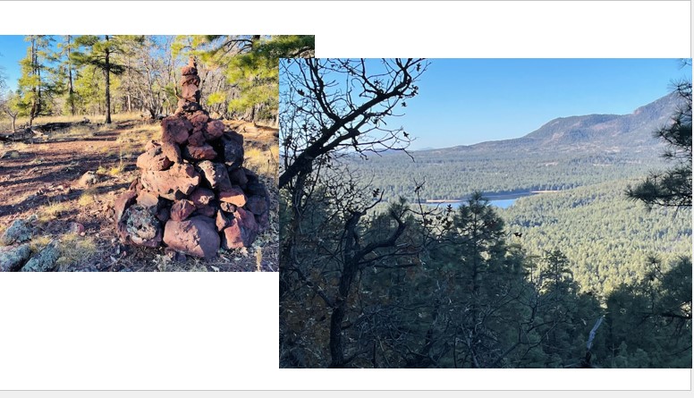
Here’s how I described said cairn (see photo, below) back then:
This is a rock-stacking extravaganza, a cairn-building project taken to a ridiculous level. We’re talking big, folks, something of Brobdingnagian proportions. This pyramid of basalt boulders must rise eight feet, perhaps four feet in diameter at its base and narrowing to a high point in which a single stone balanced precariously on its jagged edge.
If I had stopped at that description, I could have avoided angry emails and voice messages from the surprisingly vocal pro-cairn-stacking lobby. But, no, I had to go further and mention that some environmentalists and National Park officials consider cairn-stacking to be acts of vandalism.
I wrote:
It was an impressive feat, I’ll grant you, building such a ginormous cairn. Probably a good workout, too, lifting and carrying all those boulders. And then there’s the architectural acumen needed to arrange the rocks just so, lest they collapse like a poorly constructed Jenga tower. I’m sure whoever was responsible proudly took selfies in front of the cairn and posted it to social media — because, as they say, if there’s not pics, it didn’t happen.
That said, please don’t do this, people.
Scientists, environmentalists and ecoconscious nature lovers all warn that rock stacking — even if it’s just a “normal” foot-high cairn — is deleterious to the land. That, and it certainly violates the “Leave No Trace” ethos that every right-thinking hiker, trail runner, equestrian and mountain biker abide.
The problem is that, when you move rocks, you may be destroying some critter’s home. As several park rangers noted in a 2018 piece in The New Yorker, “The movement of so many stones can cause erosion, damage animal ecosystems, disrupt river flow, and confuse hikers, who depend on sanctioned cairns for navigation in places without clear trails.
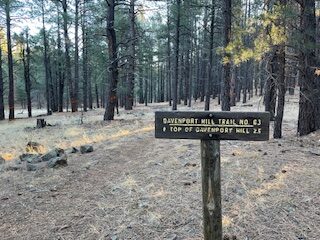
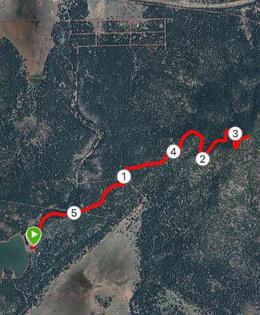
Fast forward more than four years, and I finally decided to revisit the Davenport Hill Trail, which starts at the Dogtown Lake boat ramp, traverses the Ponderosa Trail before beginning a pretty decent climb (856 feet) on long switchbacks to the summit.
In addition to wanting to feature a trail in Williams that isn’t Bill Williams Mountain, my main reason for going was curiosity.
Would the Stonehenge-sized cairn still be at the summit? Or, had either the forest service or some do-good hiker of trail runner dismantled the monument?
In 2.7 miles (the way up), I would have my answer.
But, first, a word or two about why you should head west to Williams and then take several long (but relatively smooth) forest roads to run this trail.
One reason: because it’s there!
Seriously, it’s good to mix it up every once in a while. Runners, after all, cannot live by Flagstaff trails alone – although there are enough options to last you the better part of a year without repeating yourself.
So, why not Williams?
Sparkling Dogtown Lake, pin-cushioned with Ponderosa Pines, may not feature the high-elevation peaks closer to Flagstaff, but you can more than satisfy your yen for some altitude ascension on the Davenport Trail.
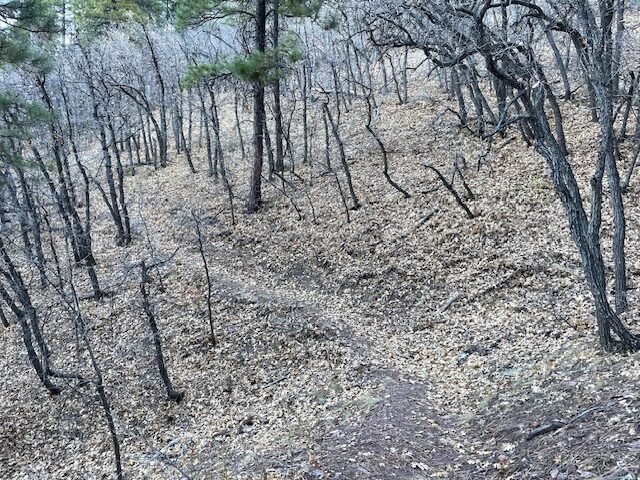
It climbs more than 800 feet in 2.7 miles of singletrack that ranges from equestrian duff to jagged rocks and, in late November, plenty of crunchy leaves and pine needles at your feet.
As hill climbing goes, it’s exceedingly doable; you’ll raise your heart rate and test your lungs, but not go hypoxic or anything. The long, gentle switchbacks — not to mention the shade from the pines — makes the journey to the 7,796-foot summit much easier, though those attempting a summer afternoon climb might get a tad warm.
The few online reports I’ve read about Davenport Hill — it, strangely, seems to fly under the social-media hiking radar — mentions the wonderful, expansive views from the summit.
Do not believe it.
The summit is tree-shrouded. Yes, there are glimpses of the San Francisco Peaks in the distance. And I suppose you could go off-trail and tramp through the brush and crane your neck to see the freight trains in Williams chugging along down below. But the views of Dogtown Lake promised from the summit are nonexistent.
It is only on the pleasant jaunt back down the winding trail that you see, down below, the dab of blue amid the carpet of green pines that is Dogtown Lake. It is a lovely image, especially framed by the trees lining the path. Incredibly, the lake (actually a reservoir, but why quibble?) seems far off, much farther than just 2.6 miles, from the vantage point near the top Davenport Hill.
Soon enough, though, you are off the hill and back on flat sections of the Davenport and Ponderosa trails, making your way back. You can extend the run by two miles by doing a loop around the flat trail encircling the lake.
OK, so. Was the cairn still in place, some four years later?
No. And yes.
The massive eight-footer was gone.
But in its place was its spawn, about a five-foot cairn not as ambitious but still of impressive height and girth.
It seems cairn-stackers are a persistent bunch, and they certainly wanted to make a mark once more on Davenport.
What do I think about it?
No comment.
Davenport Hill Trail, near Williams
Distance: 5.5 miles
Driving Directions: From Flagstaff, take Interstate 40 to exit 165 in Williams. Go left on Railroad Avenue for 2.6 miles. Turn left on Fourth Street (which becomes Perkinsville Road and then County Road 73) and go 3.8 miles to FR 140. Go 2.7 miles to FR 132. Turn left and go 1.1 mile to the boat ramp parking lot. The trailhead for the Ponderosa/Davenport Hill Trail is at the north-east end of the parking lot, across from the lake.
The Route: Start on the Ponderosa Nature Trail for 0.3 miles before it turns into the Davenport Hill Trail. Cross two fire roads and pass through two gates and keep climbing. You’ll ascend almost 800 feet in the final 2 miles to the summit. Turn around and retrace your steps to the parking lot. If desired, add a 2-mile loop around the lake on a flat trail.
Elevation Gain: 856 feet
Highest Elevation: 7,796 feet

Leave a Reply