Before launching into a reverie about the forest roads south of Lake Mary, allow me to say a few words about a sign that I saw near the end of the run on FR 132, a little west of the Priest Draw climbing area.
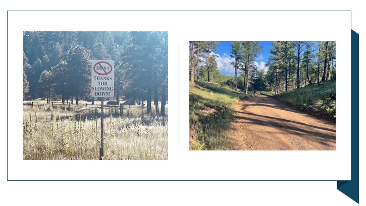
It is a sign that should be planted along every forest road in the Coconino National Forest – Kaibab, too. The message is simple, straightforward and is one that every runner – or pedestrian or mountain biker – can embrace:
“DUST (with a red slash)
THANKS FOR SLOWING DOWN!”
The sentiment is great, but while I was loping along the 12.4-mile loop of forest roads, pick-up trucks still blew by, sending a mushroom cloud of dirt in my face. Oh, but, to a one, the speedy drivers waved as they passed by, while I tried to lift a hand while choking.
OK, so I may be exaggerating just a tad. But I still want those no-dust signs planted throughout the county.
Rant over; let’s now review the lovely, mostly flat and smooth dirt trails that have enough rises and subtle descents and diverse foliage so that you never get bored. I first discovered these forest roads, and how they link in a loop, when I first moved here five years ago and parked at the Lake Mary Road “mailboxes” to do the iconic, asphalt out-and-back favored by elites and slugs alike.
I noticed, parking there, that some of the runners weren’t heading straight on the main road. Instead, they veered right and south on a paved road that soon turns to gravel and then hard-packed dirt. Then, in a pleasant coincidence, not long after, I saw a Tweet (yup, it was still called Twitter back then) by NAZ Elite’s Kellyn Taylor showing a map of her route in that very spot.
I’ve been doing that run at least once a month – except when it’s snowed in, obviously – since then.

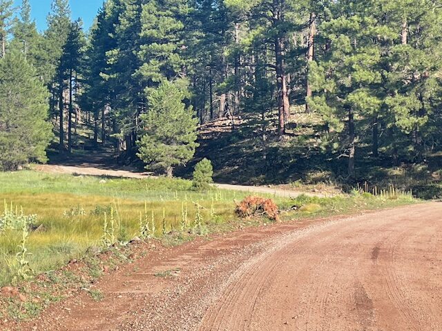
The (mostly) smooth roads snaking through the Coconino National Forest on the outskirts of town have advantages, too. You still can commune with plenty of ponderosa pines, and take advantage of the shade these stately trees bestow. You still can encounter some forest fauna, be it a prancing herd of elk or a mere frantic squirrel. And you can give your joints a break from the unforgiving asphalt while avoiding a steady stream of traffic.
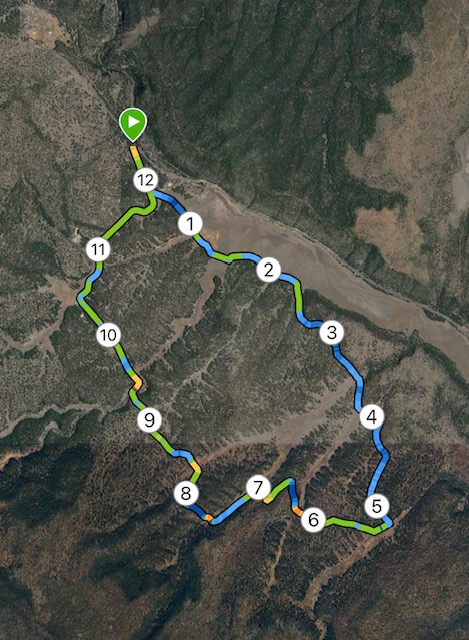
The course encompasses (going counter-clockwise) all of FR 296 to the south, then the winding FR 132d for several miles before meeting up with the main drag, FR 132, which leads you back to the start at the corner of Lake Mary Road and 132.
There are, please note, many offshoot roads and trails to add or subtract mileage, but I felt it was prudent to stick to the established route, even though Google Maps was somewhat confusing, having 132d suddenly turn into fire road 6113 and then back to 132d. (A wrong turn in an unfamiliar milieu might have me wind up in Munds Park or Mormon Lake, a little longer journey than desired.)
The first two miles on 296 are flat and mellow, partly shaded by pines and lined with car campers, but mostly exposed to the morning sun. You can see, but thankfully not hear, the traffic roll by on distant Lake Mary Road. You also pass signs next to the gravel road telling anglers to bring in their lines, the only indication that Lower Lake Mary actually is a lake at times.
After that, road 296 swerves southeast away from the lake. The road narrows slightly and is replaced by hard-packed dirt, rather than gravel. Still, it’s firm, if a bit dusty, footing. At about the 4.5-mile mark, you make a sharp right onto road 132d. (Taylor, in her run, did a half-mile out-and-back farther on 296, either because she’s so incredibly dedicated that she wanted to add mileage, or because she made a wrong turn.)
Once making the turn on 132d, you briefly are plunged into civilization. Well, three houses, anyway, with barns and equestrian facilities. There’s a troubling sign before the first house telling you this is “private property,” but we’ve been assured 132d is a public road.
There are some pleasant, non-taxing, rolling hills on this segment. Several offshoot roads, some with numerical designations, pass by, but you stay on the main road. At one point, climbing steadily, a yellow directional sign sports a left arrow. That’s really not needed to navigate, but the bullet-riddled sign gives shooting enthusiasts something to aim at.
Shortly after reaching the end of 132d, you veer left on 132 (through no sign is evident). If you go right, you’re on 296d and headed the long way back toward 296 and the lower lake. Right around the turnoff for Priest Draw, a popular climbing spot and trail, which is near more houses, you pass that welcoming sign no-dust sign.
Loop near lower Lake Mary
Distance: 13 miles.
Directions to Trailhead: From Flagstaff, drive southeast on Lake Mary Road. Just before the turn for the lower Lake Mary picnic area, turn right onto FR 132. Park at a dirt pullout near the intersection.
The Route: Start on the paved road (132) for nearly a half mile until the pavement ends and you reach an intersection. Turn left onto FR 296 and go nearly 4 miles. Make a sharp right turn onto FR 132d. Follow132d for about 5 miles until you reach an unsigned intersection. Veer slightly left onto what is FR 132 (going right is on FR 296a, taking you back to 296). Follow 132 all the way back to where you parked.
Elevation gain: 656 feet.
Highest Elevation: 6,986 feet.


Leave a Reply