Editor’s Note: Starting this week and continuing through the winter, the Trail of the Week feature will revert to a Trail of the Month, before resuming in spring to weekly with the thaw.
KINGMAN — Road trip, anyone?
No, I’m not suggesting a vacation in Kingman, lovely town though it was.
But Kingman is a great stopping point for those on the way to Southern California, via Interstate 40, or Las Vegas and beyond, via Highway 93. In fact, Kingman should lean in to that fact and advertise it on city limits signs: “Kingman: Great Stopping Point.”
Not just for gas and the freeway-convenient In-N-Out Burger, either. There are running trails in Kingman that make it a fine place to get in a run on the road, when it’s too cold or dark in Flagstaff and Vegas too far away. I find it a good way to break up a long drive, keep those joints from getting too creaky.
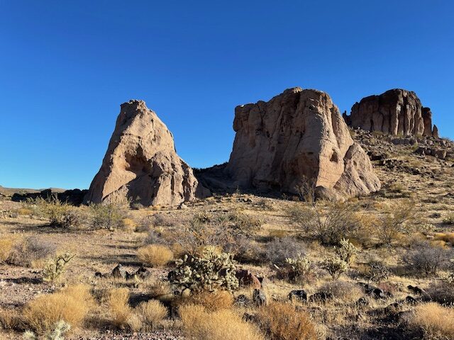
The top Kingman spot I’ve found after several forays through the scrub-and-boulder expanse is the Monolith Garden Loop, eight miles of singletrack with some modest climbs and up-close views of the rock spires that give the trail its moniker.
Best of all, the trailhead is, literally, just behind a gas station near the intersection of I-40 and Highway 93(also called West Beale Road). I mean, how convenient is that?
The trail itself might not feature the pulse-pounding, Instagram-worthy to be found on the South Rim of the Grand Canyon or on Humphreys Peak. But it’s good enough for a nice little jaunt before folding yourself back in the car and firing up another podcast.
Part of the 11,000-acre Cerbat Foothills Recreation Area, which also encompasses the short Camp Beale Trail, the provocatively-named Rattler and Sidewinder trails, and the longer Foothills Rim Trail, Monolith Gardens can be accessed two ways — via, the Metwell Trailhead just off the road or the Coyote Pass Trailhead, farther north and inland.

Because we travelers always want to “make good time” on our road trips, I’d suggest Metwell for ease of access. Just make a left turn off 93 onto Metwell (small road sign, so look for the Mobil gas station; if you get to the Economy Inn Motel, you’ve missed it), mosey on a dirt road for 0.1 of a mile, turn right, and you’re there.
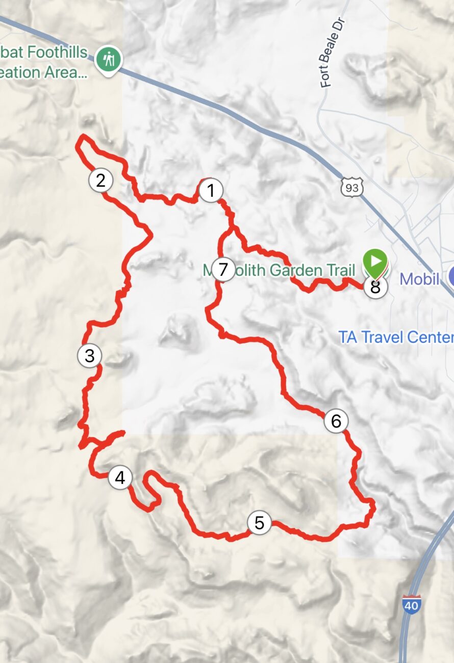
I did scant research before committing to this trek, so I was heartened to see a mini-kiosk with a map in the sparce parking area. Said map showed that there was about a one-mile climb, followed by a six-mile winding loop, then another mile back the same way.
A nice, tidy eight miles.
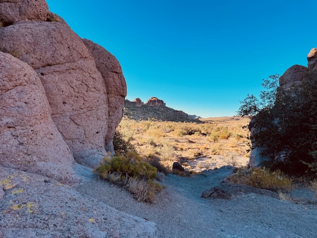
Frankly, I wasn’t sure what I’d encounter on this trail. I’m no expert on the Mohave Desert, but I expected the usual cacti varieties and some dry washes and those big boulders you see in the distance while whizzing by on the freeway.
Pretty much, that’s what I encountered.
And yet, there was so much more to see.
It was, for sure, a nice juxtaposition between a flat desert landscape and stark vertical uprisings like something you’d see in an old Road Runner/Wile E. Coyote cartoon.

I actually was more impressed by the tall, stout barrel cacti dotting the landscape than I was by the phallic-like rock spires jutting up all over. Yucca and prickly pear added some variety along the way and, even in mid-November, some grassland added a dash of color to the beige sameness.
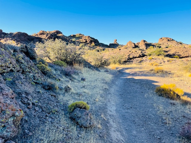
More good news: The trail is exceedingly well marked, especially the first three miles. When you make your way along the back side of a mesa around mile five, the signage dwindles, but it’s really hard to get lost. The singletrack is laid down so that runners get to trot by most of the large rock outcroppings, and the circuitous route it takes is kind of fun, doubling back on itself at a couple of junctures.
You’ll never know what you’ll find, either. Nearing mile six, after descending the biggest climb of the loop (which really isn’t that big), all of a sudden, you find yourself running on the edge of a ravine, with an impressive canyon down below.
How technical is the footing?
I knew you’d ask that. It’s rocky in many places, especially the first mile on that connector trail. After that, the path alternates between jagged rock and smooth, sandy sediment. In other words, a nice mix.
Depending on whether you stop to admire the giant rock formations — and risk seeing snakes come slithering out of the crevices — you can polish off the loop in about 1 hour 15 minutes, if you do a mellow, steady-state.
Then, you’ll be back on the road, headed to either Vegas of Barstow and feeling like you accomplished something on the drive.
Monolith Garden Loop
Distance: 8 miles
Driving Directions: From Interstate 40 going west, exit at West Beale Street (Highway 93) heading toward Las Vegas. After about a mile, turn left on Metwell Drive and go 0.1 of a mile to a dirt road. Turn right at the Monolith Garden Trail sign.
The Route: Start just to the left of the kiosk at the trailhead. Go about a mile on the singletrack until you reach the first junction, then keep following the Monolith Garden Trail directional signs for the next six miles. Once the loop is completed, return on the connector trail to the trailhead.
Elevation Gain: 810 feet
Highest Elevation: 3,657 feet


Leave a Reply