Hey, how’s that Imogene training going, you Flagstaff locals? Tired yet of the Sisyphusian climbs up Humphreys, Elden, Kendrick and O’Leary peaks? Looking for something different in the final month before the annual 17.1-mile Ouray to Telluride race that Flagstaffians so cherish?
How about Slate Mountain?
What, you say, it’s only a 2.3-mile climb? Maybe as a recovery run, right?
OK, but hear me out.
There’s this training modality called “repeats,” and Slate Mountain is perfect for say, three repeats to the summit and back down for a total of 13.8 miles and 2,538 feet of elevation gain. The only downside is, you don’t get past 8,200 feet, unlike the five-figure (or close) elevation of the more popular training runs.
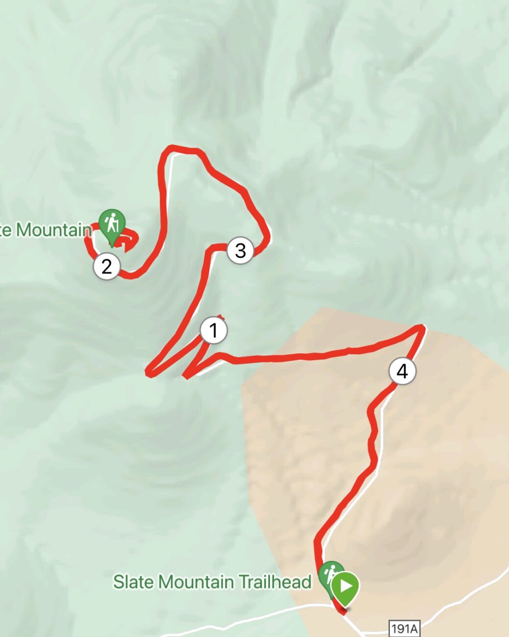
For the rest of us, slugs like me who aren’t running Imogene this year, one 4.6-mile up-and-down (846 altitude gain) on Slate Mountain is just right. But if you think it’s silly to drive 26 miles west of Flagstaff to not even get the Garmin to 5 miles, you can add another four miles by parking at the pullout on the corner of Highway 180 and Forest Road 191 and running two miles each way to the trailhead.
I’ve run Slate mountain at least twice a year since 2019, and I’ve yet to see anyone else on the trail. For me, that’s a plus. That’s because Slate needs some better PR.
Squat and lumpy, overlooked and misnamed, Slate is not the loftiest or most impressive of peaks among the extrusions that dot the San Francisco volcanic field. But I’m here to report that what Slate Mountain lacks in beauty and grandeur it more than makes up in brains, an accessible trail personality and a slightly pinkish complexion.
This is a good trail for beginning trail runners. Sure, it’s 2.3 miles of continuous climbing, but it’s a gentle climb. There are no overly steep, hands-on-knees sections; rather, you traverse only a few switchbacks, but they’re gradual and doable. That is not to say you won’t get a workout. It’s a great hill workout because the path is wide, even the singletrack portions, and not that rocky — despite the trail’s deceiving name.
OK, about the name, Slate Mountain: It’s a misnomer. You won’t find any slate, which, as you’ll recall from high school earth science courses, is a metamorphic rock not found in volcanic zones.
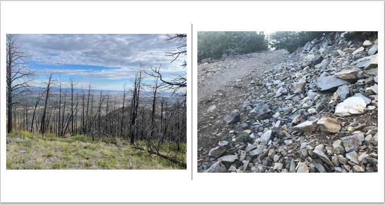
So those jagged slabs of rock that litter the trail and hillsides are actually rhyolite, an igneous rock that, during the mountain eruptive phase some 1.5 million years ago, did battle with sedimentary strata and sent slabs scattering to the surface. That also accounts for the pinkish tinge to parts of the trail, especially in the first half-mile from the trailhead.

Rhyolite’s high silica content is a result of granitic magma that cooled on the subsurface (thanks, geology.com for the primer). I stopped and caressed a few rhyolitic stones, and the texture is nothing like the smooth, flaky slate. Instead, it’s rough and nubby, with tiny vugs (thanks again, geology.com, for teaching me a new word) with the feel of a teenager’s acne-scarred face.
Apparently, the passing resemblance to slate gave whoever was charged with naming the mountain inspiration. After all, calling it Rhyolite Mountain, while geologically accurate, just wouldn’t have the same dramatic ring to it.
Another point in the Slate Mountain Trail’s favor: it’s educational.
Actually, you can learn lots about nature from every trail, but Slate Mountain makes it easier for users. Lining the path from the trailhead nearly to the summit are signs explaining the flora therein.
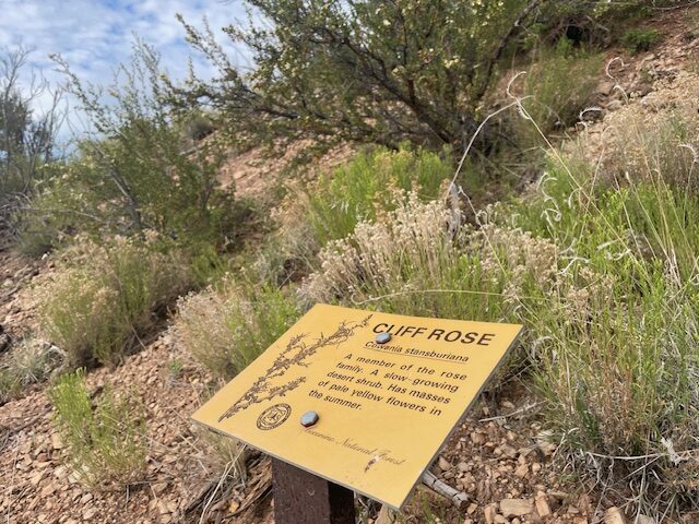
Some are pretty obvious — this is a ponderosa pine; this over here, an alligator juniper — but others are enlightening to the lay person. I never knew, for instance, that the kind of ragged, low-slung, dark-barked plant is called Mountain Mahogany, and that deer consider it quite the treat. That’s why, according to the Coconino National Forest sign, “the pruned appearance of this plant is the result of browsing by deer.”
It also was nice to finally match a name to the face of the tiny yellow-flowered bush I often see on trails: it’s cliff rose.
Experienced runners won’t need these planned respites, because the Slate Mountain Trail is not too taxing. Though a sign at the trailhead states the distance to the summit is 2.4 miles, my GPS watch charted it as 2.3. But that’s quibbling. It’s a short but vigorous workout. Be mindful of what time of day you attempt it, though, since there is scant little shade.
There are nice views, too. The clearest spot to gaze upon the San Francisco Peaks comes about halfway up the trail, where trees fall away and the mountain just seems to loom over your left shoulder.
At the summit, the pines go away, so that you get an unobstructed view of Kendrick Peak to the south and the cinder cones of the San Francisco volcanic field. One online site, hikearizona.com, says that on a clear day you can see all the way to Navajo Mountain in Utah. Well, maybe I wasn’t looking in the right spot. Regardless, the views are worth the trip.
And the trip down? Because it’s not too steep or too rocky, you can scamper with abandon downhill, being careful, of course, of other trail users heading up. But Slate Mountain is so little used that you probably won’t encounter too many people along the way. That’s another advantage of not being a beauty queen of a mountain.
Top of Form
Bottom of Form
Slate Mountain Trail
Distance: 4.6 miles
Driving Directions: From Flagstaff, drive about 26 miles on Highway 180 (just pass mile post 242) and turn left onto Forest Road 191. Drive 2 miles to the trailhead.
The Route: Starting from the dirt parking area, look for the trailhead to the south. Follow the trail for 2.3 miles as it winds its way up the mountain. At the summit, retrace steps back the trailhead.
Elevation gain: 846 feet.
Highest elevation: 8, 200 feet


Leave a Reply