Rarely do you experience what I call a Robert Frost Moment at the very start of the run, but that’s what happened the other day when I pulled into the Sunset Trailhead lot off Schultz Pass Road.
There, before me, lay the Sunet Trail to the left and, not 20 feet away on the right, the newish Broadside Trail.
Wait, Robert Frost? What does that dead white male poet have to do with trail running? Here’s what: Remember his famous lines from “The Road Not Taken”:
Two roads diverged in a wood, and I—
I took the one less traveled by,
And that has made all the difference.
Contemplating my choices at the trailhead, I weighed the familiarity of the good ol’ Sunset with the beckoning of a shiny new trail, Broadside, that is part of the 2023 Mount Elden/Dry Lake Hills (MEDL) project.
Thing is, the trails sort of parallel each other and lead to the same point – a plateau where the Sunset tops out and then descends toward the Upper Brookbank Trail. The distance from the trailhead to that preliminary summit is 2 miles via Sunset, and 3.2 via Broadside. But word on the street (or, rather, the trails) is that Broadside is much smoother and a more gradual climb.
You can probably discern which way I went. Gotta check out the new trail, even though it’s been in existence since late 2023.
My plan was to do a 7.5-mile loop starting on Broadside, intersecting for 0.3 of a mile on the Sunset, then looping around the Upper Brookbank Trail down to the new MEDL-constructed singletrack, the Swell Trail (which, roughly, follows the same contours as the erstwhile Little Gnarly Trail) before catching the last part of the Schultz Creek Trail back to the Sunset Trailhead.
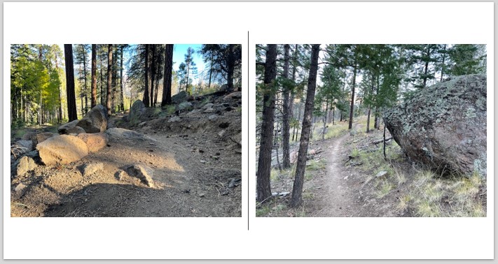
Right away, as I stepped foot on the Broadside, I could tell I was in for a mellow climb – a nice way to ease into the run on a chilly early morning. It’s definitely lacks the steepness of the early, lower Sunset route and has less technical terrain (rocks, in other words).
Cruising up Broadside, it really doesn’t feel as if you’re racking up that much elevation. But, in fact, you are gaining 637 feet in the first 3.2 miles.
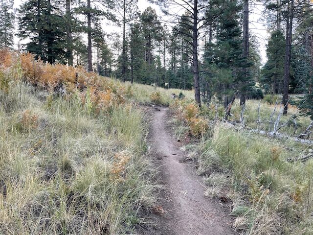
Part of what makes Broadside bearable and — dare I say it, fun – is a series of zig-zagging switchbacks that break up the monotony. You traverse a smooth singletrack through a meadow dotted with Ponderosa pines, a few large boulders to distract you and charred remnants from fires past.
I could envision mountain bikers bombing down Broadside and having quite a wild ride. But, fortunately for trail runners, another new route heading down has been blazed especially for those on two wheels. It’s the Full Sail Trail, near the junction where Broadside meets Sunset. As the large, colorful sign explains, Full Sail is “1-Way Bike Trail, Downhill Only” and with this admonition: “Hikers & Equestrians – Not Recommended.” (In other words, runners and hikers can’t be banned from the trail, but it won’t be pleasant once the bikers blow by you.)
Runners won’t fully appreciate the well-groomed Broadside Trail until they make the right turn and go downhill for 0.3 of a mile on the Sunset, heading toward Upper Brookbank. That section of Sunset is rough: two large downed trees cover the trail and assorted branches and exposed roots make for slow, crunchy going.
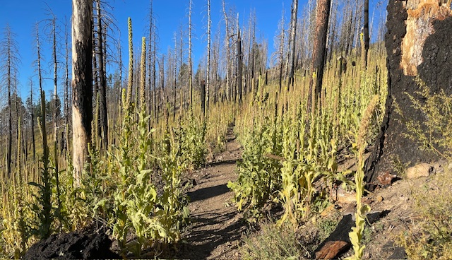
Things get better once you make the right turn onto the Upper Brookbank. There’s an initial, rocky climb, but soon it flattens out and, while not devoid of technical obstacles, is much more runnable. On this late September morning, the wild invasive mullein (thanks for the botanical ID, Picture This- Plant Identifier app) was taller than I was and lining the path like acolytes cheering me on in the morning breeze.
Once you’ve curved around Brookbank, seeing more post-fire devastation, you reach the meadow near the apex of the Dry Lake Hills. To the right (north-west) is the new turnoff for the Swell Trail. This is in the same area as the old, decommissioned Little Gnarly Trail, only better constructed and entirely singletrack.
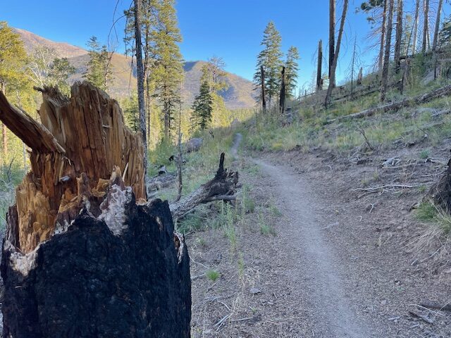
The Swell is about as smooth and rock-free as the Broadside and provides nice views of the mountains before dipping low to meet up with the latter stages of the Schultz Creek Trail. It’s a 412-foot downhill over 1.4 miles, a pleasant jaunt. Sure, there’s some minor climbing left after you turn right onto Schultz Creek, but you know you’re on the homestretch, soon to be done.
Without a doubt, this modest mountain loop was the easiest, most enjoyable time I’ve had while gaining 928 feet and getting close to 9,000 feet.
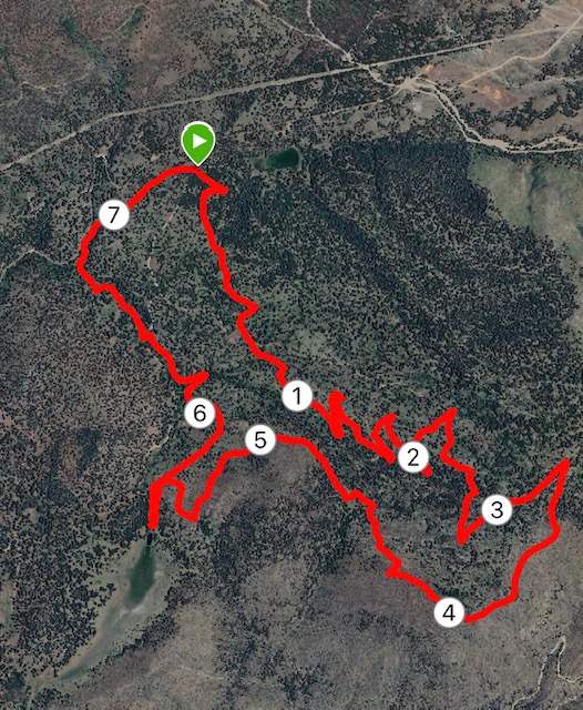
Broadside-Sunset-Brookbank-Swell-Schultz Creek Loop, 7.5 miles
Driving Directions: From Flagstaff, take Fort Valley Road/Highway 180 to the Schultz Creek turnoff heading north. At the “Y” (the intersection with Mount Eldon Lookout Road), veer left to stay on Schultz Creek Road and drive about six miles to the Sunset Trailhead.
The Route: From the parking lot, go 3.2 miles up the Broadside Trail. When the Broadside ends at the Sunset Trail, make a right to stay on the Sunset Trail, going downhill. After 0.3 of a mile, turn right onto the Upper Brookbank Trail. Follow that about 2.5 miles to the start of the Swell Trail. Take the Swell Trail 1.4 miles (look for signs at intersections) and then turn right onto the Schultz Creek Trail to return to the trailhead.
Elevation gain: 923 feet.
Highest Elevation: 8,870 feet.
Leave a Reply