Want some more turkey? Of course, you do. We’re not talking about Thanksgiving and those L-Tryptophan heavy dinners. Rather, how about another local trail named “turkey” to whet our running appetite.
Last week, it was Turkey Hill.
This week, Turkey Creek.
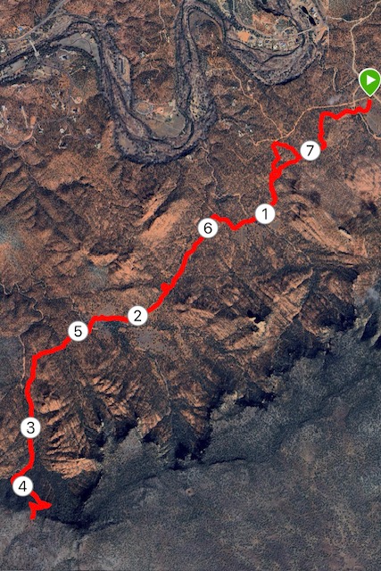
Specifically, it is the Turkey Creek to House Mountain out-and-back, a lovely 7.6-mile journey west of Oak Creek Village.
This one, admittedly, takes a bit of effort to get to. It’s located way at the south end of Sedona’s famous red rocks, and I’d recommend getting there via Interstate 17/Highway 179 than schlepping down the switchbacks on 89A and navigating the tourist traffic.
Is it worth the trip?
Absolutely.
The Turkey Creek Trail has got to be one of the remotest and least-trod hiking and running paths in all of red-rock country.
That’s saying something, because with the weather cooling and the holidays approaching, Sedona trails routinely become maddeningly packed. Don’t even try to run Bell Rock or Vultee Arch or even the Jim Thompson Trail, not unless you enjoy bobbing and weaving past folks with trekking poles sticking out like daggers and printouts of all the local vortex spots.
Not so at Turkey Creek, which is only a mile or so on a dirt road beyond the Verde Valley School.
When I first visited in 2020, I encountered nary a soul. And, in subsequent years, trail use (at least when I’ve ventured there) has been sporadic. The big test came on my last foray; I chose a sunny, mild Saturday morning in early November.
Yes, there were other trail users. No, they were not plentiful. And, once you start the real climbing up to House Mountain, you’ll most likely not have much company.

The official trailhead is slightly more than a half-mile after you take a left off of Verde Valley Road onto a pitted, rocky and altogether miserable dirt road, best traversed with a high-clearance vehicle lest one ends up stalled and crashed like that SUV at the mountain top.
May I suggest an alternative, though?
Make a quick left once you negotiate the turn off Verde Valley Road and park at a smaller, somewhat makeshift trailhead at the intersection. It’s not “officially” a part of the trail — and it adds almost a mile to the total distance of the trek — but it will save the suspension on your car. Plus, that first segment, about 0.7 of a mile, is a pleasant, winding journey along mostly smooth singletrack favored by mountain bikers.
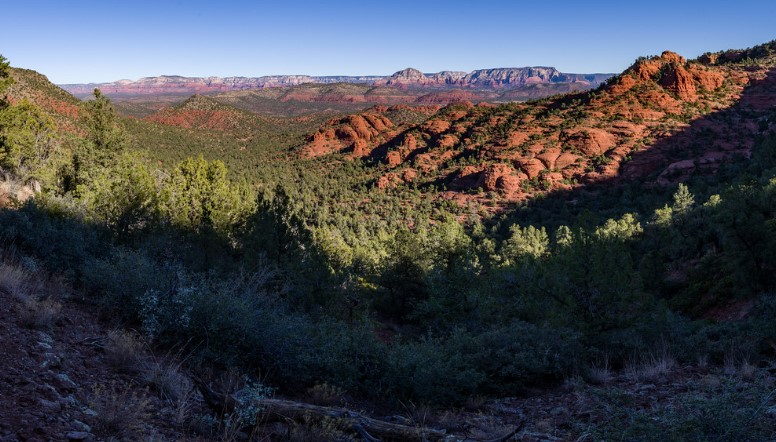
Eventually, you’ll hit the actual trailhead and, from there, a series of “official” cairns (rocks collected in baskets) shows you the way for the next mile or two through a succession of valleys that afford views of the vast expanse of red-rock country.
Once the cairns go away, and once the flora thickens and rocks start peppering the trail, you’ll know that the climbing as begun leading up the north face of House Mountain to the lip of the caldera.
At first, it doesn’t seem steep. But it’s deceptive. Only in the final three-quarters of a mile does the “killer vert” assault your oxygen-deprived lungs. According to my GPS watch, admittedly not absolutely scientifically valid, the final mile to the top is a 535-foot elevation gain. Not a bad workout.

One thing that bothered me, though. Why is the trail named Turkey Creek? I saw no turkeys, not even any javelinas. (Come to think, I didn’t detect a creek anywhere along the way, either, and this was at the height of winter.) You do cross over some dry washes; could that be the creek in question?
Since most of the climbing came on the “out” portion of this out-and-back, the trip back down is like gliding. You can pick up your pace and let the calming sight of agave, pinon and junipers guide you back to the trailhead.
Next week, we’ll revert to non-turkey trails. I briefly thought of making it a trilogy and traveling to Turkey Springs Trail in the Tonto National Forest, near Payson, but decided not to gorge myself on turkey.
Turkey Creek Trail to House Mountain, Oak Creek Village
Distance: 7.6 miles (from trailhead closes to Verde Valley Road); 6.8 miles (from official trailhead)
Driving Directions: From Flagstaff, drive 24 miles south on Highway 89A to Sedona. At the junction roundabout, turn left onto Highway 179. (Or take I-17 to 179 to avoid traffic). Travel 7.2 miles south into the Village of Oak Creek to Verde Valley School Road. Turn right and go 4.5 miles to a left turn with a directional sign for Turkey Creek Trailhead. The official trailhead, with a bigger parking lot, is a half-mile south along a rugged road best traversed by high-clearance vehicles. No cost for parking.
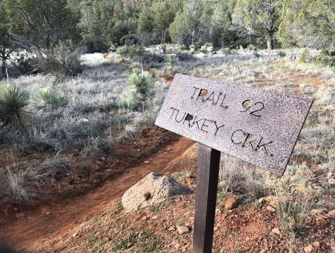
The Route: From either trailhead, follow the well-marked path for either 3-2 or 3.8 miles to the north lip of House Mountain. Along the way, watch for the Turkey Creek Tank area, where a metal post alerts you that this is Turkey Creek Trail. Make a left at the sign to continue.
Elevation gain: 993 feet.
Highest elevation: 4,632 feet.


Leave a Reply