My trusty, well-worn and old-school fold-out Flagstaff Trail Map, circa 2021, does not list the Turkey Hill Trail.
That’s why, until recently, I had no idea it existed.
But thanks to the OG Trail GangstAZ, Ruairi Moynihan, I’m now enlightened to this short, steep cinder-cone bump just east of the Picture Canyon Preserve.
Every Thanksgiving for, well, at least a couple of years now, the Trail GangstAZ have gathered for a ritual run up Turkey Hill – and, of course, back down – before the members disperse to begin their fowl gorging. The past two years, the gang has been joined by an elite or two – one year, Olympic medalist Molly Seidel, another, trail pro Jeff Browning.
In advance of this year’s Turkey run, I decided to experience the trail for myself without bothering to check first with Moynihan, who was probably out running in some remote spot anyway.
I went Cold Turkey, you might say.

Turns out, it was a fairly simple out-and-back as long as you keep heading north toward the hill straight ahead and not get distracted by some side forest roads.
As I pulled into the makeshift “trailhead” a mile east of the Flagstaff Mall, at the corner of Route 66 and Forest Road 791, I was amazed that I’ve lived here five years and hadn’t known about this trail. Then again, I’m more of a West Flag guy and whine about having to drive alllll thhhhe waaaay to the eastside.
You know you’re at the right starting point when you see a pullout off of 66 and a bunch of mailboxes. You can park there or make the left turn onto FR 791 and park on the side there.
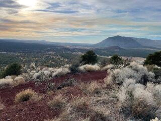
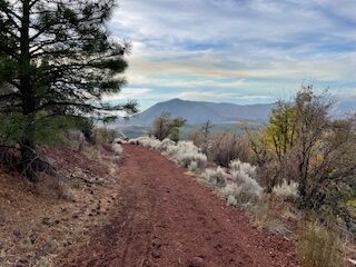
Ahead looms Turkey Hill about a mile up ahead. You can literally see the trail winding up and around the hill itself, which is a little daunting at first. But I figured that it can’t be too bad if that stretch was the only climb.
I figured wrong, though.
That first mile on FR 791offers 236 feet of elevation gain. So much for easing into things. The climbing starts right away with a short, steep rise, flattens out a bit and then climbs slowly for the next three quarters of a mile.
It’s mostly forest road, wide and not too rocky or eroded in that first mile. The only hazard is motorized vehicles. As I was chugging along, I heard a roar coming from behind. Before I even had a chance to look back and move over, a motorcyclist zoomed past, kicking up a mushroom cloud of dust in his/her/their wake. Just when the dust was settling, two pickup trucks came the other way and reserved the dust cloud formation. The trucks, at least, weren’t gunning their engines as much.

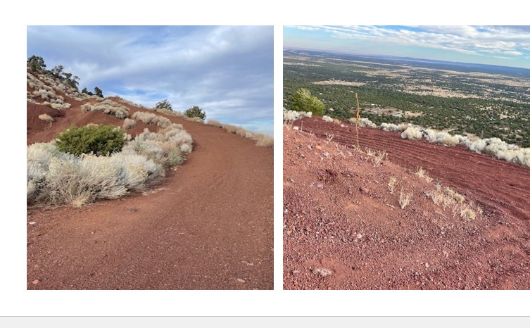
But once you get past the junction with FR 510B on your right – you stay straight up towards the hill – there is no more traffic with which to deal. The trail surface, too, changes to a looser, cinder-ish surface, soft of the feet but a little sluggish for swift uphill movement.
At 1 ½ miles into the run, you reach a plateau that gives you two options for continuing up to the tippy top. I looked to my right, and the road rose steeply but you could see a flattening (sort of) after a while. I looked to my right, and the road rose steeply and kept on rising.
Either way, there was climbing ahead. I made the executive decision to go right and, yeah, it was steep, and then veered sharply to the left for more climbing before a short, sharp right and – you guessed it – more climbing. Another left leads to a flatter climb in a curlicue up to the summit.
My watch hit two miles right at the top, so I figured I had taken a slightly shorter route to the top. Total elevation gain in two miles: 722 feet.
The view?
Lovely. Not exactly from dizzying heights, a la Mount Elden or the Peaks, but pretty darn nice views of Doney Park to the north and east and Elden to the west, not to mention a look down on the grand sphere that is the Purina Dog Food tower.
My return trip, sans shortcut, added an extra three-tenths of a mile. Not a problem; it was pleasant descent, not too steep to jostle my aging knee joints.
I’m not sure I’d make Turkey Hill a regular part of my trail arsenal, but it’s fun for a nice diversion. Plus, it’s close enough to the Arizona Trail segment 31C – or even the Campbell Mesa trails – to include it as part of a longer run.
In the meantime, click here for more on the Trail GangstAZ’s annual turkey trot up Turkey Hill.
Turkey Hill
Distance: 4.3 miles (out and back)
Driving Directions: From the Flagstaff Mall, take Marketplace Road, turn right on Test Drive, then turn left on Route 66. Look for the mailboxes and an unmarked forest road on the left (north side) of Route 66. Park there.
The Route: Starting on FR 791, head north, staying on the main trail all the way up the hill. Retrace steps back to your car.
Elevation gain: 745 feet
Highest Elevation: 7,430 feet


Leave a Reply