Leave it to the Germans, known for their precision with language and most everything else, to come up with just the right word to describe the ineffable feeling of being alone in the woods, both the pleasures and the loneliness experienced therein: waldeinsamkeit.
Come to think, the Japanese have a phrase that is somewhat similar, shinrin-yoku, which is said to mean “forest bathing.”
Both words are too subtle for direct translation because they evoke inchoate feeling more than something definable. But the way I interpret those concepts is a mingling sense of both calm and exhilaration, a satisfaction in being alone but hardly lonely, joined by the trees waving branches, the wind sighing and the wildlife stirring.
I always feel that way when I hie myself over to run the Arizona Trail’s Walnut Canyon Rim segment in the predawn stillness. It soothes, as they say, the savage breast and serves as a resetting of one’s internal equilibrium, which I badly needed on my latest trip, coming with the anxiety-spiking election fast approaching and all the noise that clutters one’s thoughts and makes a guy Google asylum laws in Canada.
People flock to the Walnut Canyon rim portion of the AZT, designated Segment 31B for those counting at home, because of the gorgeous views to be had taking a few side trails along its 6.4-mile way. And I don’t begrudge them that. Not in the least.
But on this morning, the day just dawning, the AZT itself was the attraction. Because much of the early going is relatively flat and non-technical, you can let your mind and spirit wander and, yes, immerse yourself in this forest bath.
At the trailhead, the waning moon was still visible but receding, its evening illumination completed. And as I wended my way through the shadows of the first mile, the pinkening of the morning emerged on the eastern horizon. I turned a corner and caught the sublime image of the sun sending diluted filigrees, bursts of light winking like gold coins, into the fading shadows.
A feeling of intense waldeinsamkeit washed over me at that moment. Gone, at least temporarily, were thoughts of potentially disputed elections, rancorous debate, and that nameless dread that always seems to dog me. A brief plunge down some rocky switchbacks temporarily breaks the fugue state, but focuses the mind on the task at hand into a brisk breeze, before calmness resumed.
The chill in the air persisted until the first turnoff for the overlook, a 0.2 of a mile detour that seemed obligatory in the Walnut Canyon rim experience. Turning east, toward the edge, the dappled sun took on more prominence, the warming rays reason enough to continue on. The side trail, please note, does not lead you directly to the overlook. Some dense foliage, and a barbed-wire fence, blocks the view.
There is, however, a crudely constructed wooden ladder, missing a rung or two, built into a portion of the fence near the side trail’s terminus. No sign prohibiting its use was evident, nor was there warnings posted about creeping out on the cliff’s edge.

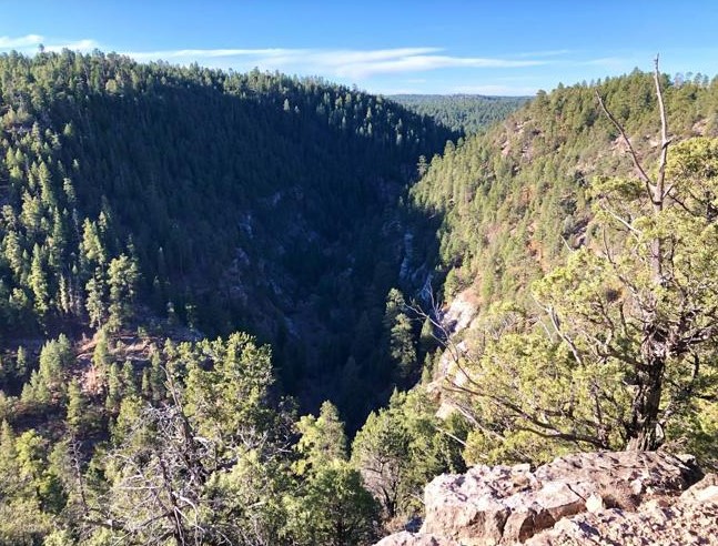
So, of course, I hoisted myself up and over and crept carefully toward the overlook. This is the way people perish, I castigated myself, with smartphone in hand going for that perfect Instagram photo at the rim’s precipice. Therefore, I gave the edge a wide berth, lest I tumble 400 feet down. But even from a safe distance, the view was more than worth it, shadows spreading out from the south rim while to the west the tops of ponderosa pines glowed and the cloudless sky stretched out for miles. All that was missing was a hawk or eagle — heck, I would’ve settled even for a crow — soaring over the expanse, but you can’t have everything, can you?
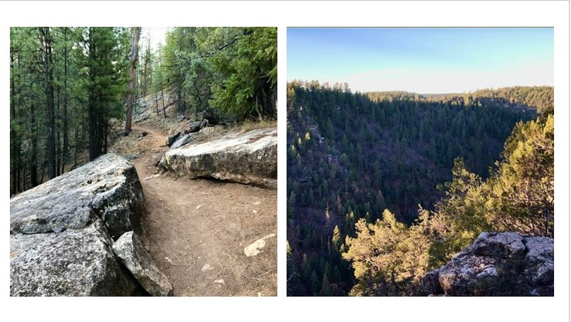
Back on the Arizona Trail, I then followed a mellow, rolling stretch to bring back that peaceful feeling. I caught glimpses of the San Francisco Peaks at various points, but, really, I was content with simply wandering through the oak and pine trees lining the path, which was carpeted by crunchy leaves and pine needles.
Another trail offshoot for an overlook beckons — 0.7 on a mile one way — but this time I took a pass. I wanted to reach Fisher Point without running into any other trail user, which is pretty rare on the AZT, early in the morning. It’s not that I detest humanity or anything; but I didn’t want hikers or mountain bikers to intrude upon my shinrin-yoku.
The final two miles before Fisher Point gets rockier and hillier, but that bother is offset by the sharp south turn the trail takes to run parallel along the rim, affording great views without lengthy detours.
Fisher Point is a popular spot, but I had it to myself. I lingered, taking in the view of the Sandys Canyon Trail below, where two dots appeared to be runners getting in a workout.
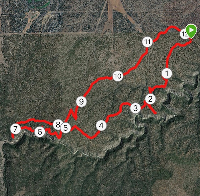
As for me, my latest venture on the AZT along Walnut Canyon couldn’t have been more relaxing. So perfect, if fact, that I didn’t want to spoil it by retracing my steps back to the trailhead for a 13.6-mile total. Instead, I wimped out and hoofed it on Forest Road 301 all the way back to Old Walnut Canyon Road (FR 303) and the trailhead, a loop that cuts off a good 1.5 miles.
Once finished, I was calm, focused and ready to face whatever calamities the election has to offer.
AZT: Walnut Canyon to Fisher Point
Distance: 13.6 miles (out and back); 12.1 miles (returning on FR 301)
Directions to Trailhead: From Flagstaff, take Interstate 40 to the Country Club Drive exit. Go south and turn left on Old Walnut Canyon Road. Once the paved portion of Old Walnut Canyon Road ends, go about two miles to the AZT trailhead.
The Route: From the trailhead, follow the well-marked AZT for 6.4 miles to Fisher Point. (You can take two side trails to canyon overlooks, one a 0.2-mile one-way detour; the other 0.7 miles one way.) From Fisher Point, either retrace your steps back to the trailhead for 13.6 miles or take signs on the left for the well-manicured and reasonably flat FR 301 to FR 303 (Old Walnut Canyon Road) for a 12.1 round trip.
Elevation gain: 780 (out-and-back on AZT); 671 (AZT and FR 301)
Highest elevation: 7,047 feet


Leave a Reply