Decades ago, I attended a lecture at Cornell University by the late, great novelist Kurt Vonnegut. It was March and miserable in Ithaca, N.Y., if memory serves. Snow-encrusted sidewalks, black ice on the roadways, biting chill in the air. Typical Ithaca.
That night, Vonnegut went on a riff that has stayed with me all these years. He said – and I paraphrase – that March is not Spring; rather, it is the Unlocking Season. By that, I took his meaning to be that, though the calendar states that late March and April are Spring, it really is a gradual thawing.
Some internet searching resurrected Vonnegut’s exact quotes (apparently, he’d given this spiel many times before):
“Here is the truth about the seasons: Spring is May and June. What could be springier than May and June? Summer is July and August. Really hot, right? Autumn is September and October. See the pumpkins? Smell those burning leaves? Next comes the season called Locking. November and December aren’t winter. They’re Locking. Next comes winter, January and February. Boy! Are they ever cold! What comes next? Not spring. ‘Unlocking’ comes next. What else could cruel March and only slightly less cruel April be? March and April are not spring. They’re Unlocking.”
Why bring this up now in what is purported to be a trail review about the Campbell Mesa Loop in East Flagstaff?
Because, with the onset of March and a spate of drier weather in town, I felt it was safe once more to test the Flagstaff trails, see if the snow had receded enough to allow a proper runner’s gait.
Higher in the mountains? Not yet, and probably not for a while. Near my neighborhood in West Flagstaff? Nope. Wing Mountain (FR 222) off Highway 180? Still snowed in.
But Campbell Mesa is on the eastside and, though there are lots of trees, the 12 miles worth of trails near the golf course is not that shaded. I felt confident in going, though I brought snow spikes just in case and road shoes in case I would have to bag it and hit the streets.
Happy to report that there was nary a flake of snow at Campbell Mesa. And, though the temperature was 26 degrees at 7 a.m., no frost was evident, either. The spikes stayed in the car at the trailhead.
I like traversing Campbell Mesa because it’s a trail run you can do on an easy or recovery day. The trail system features four interlocking routes that that can be traversed separately and be as short as 1.8 miles in length or strung together to total a challenging but exceedingly doable 12 miles. Plus, there’s slightly less than 500-feet of elevation gain for the whole course and you never even hit the 7,000-foot altitude point.
Another bonus: It’s smoother than a lot of trails. There are patches of minor rock gardens on each loop, but the vast majority of trail is level and free of obstructions that might draw blood.
The worst stretch is a quarter-mile downhill on the Walnut Meadows Loop near the connector to the Arizona Trail, where I once witnessed a mountain biker take a ghastly spill, body-over-handlebars, when the boulder was rude enough to impede his speedy descent. (Said biker, dusting himself off, claimed it was merely a flesh wound and that, no problem, he meant to do it.)
For runners and hikers, I’d recommend coming to Campbell Mesa when you are scheduled for a “recovery day” — meaning your body is sore and aching after a workout or a hilly and technical trail run in, say, Sedona.
And I’d also recommend you start your Campbell Mesa sojourn early in the morning — say, before 8 a.m. — to avoid conflict on the singletrack with mountain bikers hell-bent on bombing the downhills. Actually, that gives mountain bikers a bad rap. Most of the mountain bikers I’ve encountered at Campbell Mesa are courteous and call out “On your left” well before zooming by with impunity.
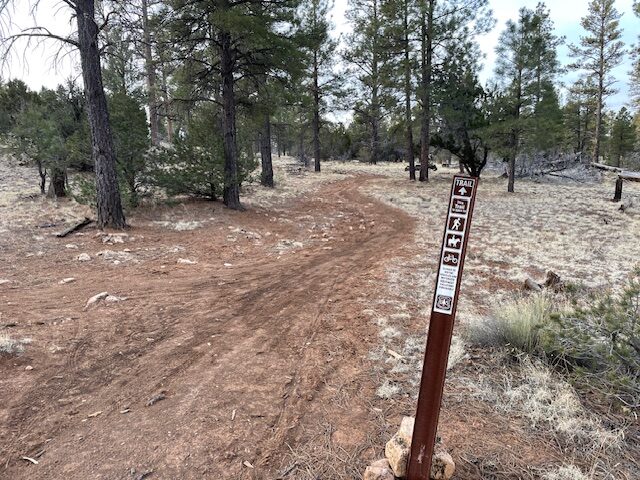
Users can pick and choose which loop to take, since there’s a universal trailhead for each close to the parking area off of East Old Walnut Canyon Road, not far from the geese-infested golf course.
I chose a three-loop, 10-mile route that starts incredibly easy and progresses in difficulty thereafter. That way, if sore from previous vertical challenges, you can ease into it and get your thrashed carcass warmed up before the gentle hills come into view.
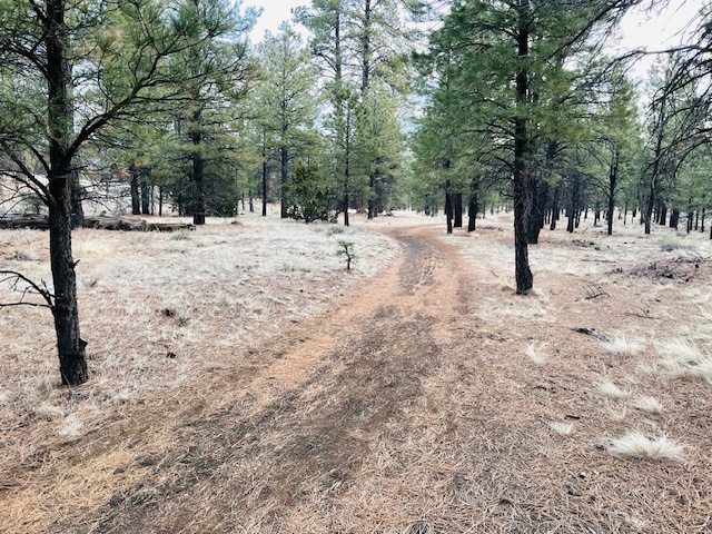
First, do the 1.8-mile Continental Loop, just to the northwest of the parking area. It’s a mostly wide, flat and smooth path, as close to doing the well-manicured FUTS as you’ll find in a trail system. If you traverse it counter-clockwise, the first rocks you’ll encounter come more than a mile in, and they are easily hopped.
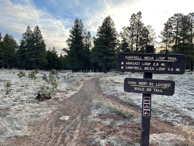
Once back at the trailhead, taking the 5.7-mile Campbell Mesa Loop (going clockwise) will continue the gradual transition from easy to harder. The most popular of the routes, the eponymous Campbell Mesa Loop winds through ponderosa pine, Gambel oak and some meadows where turn-of-the-20th Century sheep rancher and state legislator Hugh E. Campbell tended his flock.
There really are only three hills on the Campbell Mesa Loop, none too taxing. The most climbing you’ll do on any is 50 feet before reaching the Walnut Meadows Loop junction about 6.6 miles into the total run. (One logistical note: About three miles into the Campbell Mesa Loop, at the crest of a small hill, avoid taking an offshoot trail northeast, signed “Loop Trail.” That will take you to a tunnel under Interstate 40 and across Route 66 to pick up the Arizona Trail. You want to keep going straight as the Campbell Mesa loops around south and to the west.)
The Walnut Meadows Loop is the hardest of the three, though it starts out as a flat, smooth singletrack marred only by mud-dried tire tracks. Suddenly, though, you are greeted by a steep downhill and a treacherous rock garden. It’s downhill, which makes it dicier still. By the time you reach the connector to the Arizona Trail (don’t turn left onto it), the route flattens and returns to its mellow path for another two miles back to the trailhead, gawking at prime views of Mount Elden.
You will have worked up a sweat and elevated your heart rate on this 10-miler, but you will have given your legs a break.
Campbell Mesa Trails
Distance: 10 miles: Continental Loop to Campbell Mesa Loop to Walnut Meadows Loop, back to Trailhead; 1.8-miles (Continental only); 5.7 miles (Campbell Mesa Loop only); 3-miles (Walnut Meadows Loop only).
Directions to Trailhead: Take Interstate 40 East, exit at Country Club Drive. Go right on Country Club and turn left onto E. Old Walnut Canyon Drive. Trailhead parking will be on the left.
The Route: Trot 300 feet east to the trailhead for all trails. For the 10-mile blending of three loops, start on the Continental trail, then go on the Campbell Mesa Loop clockwise and then turn left on the Walnut Meadows Loop (about 6.6 miles into the total trip). Take Walnut Meadows back to the trailhead.
Elevation Gain: 498 feet
Highest Elevation: 6,871 feet
Leave a Reply