A trip down-mountain to Phoenix for personal business beckoned, and I’ve got to say that, this time, I wasn’t dreading the drive and leaving behind our beloved Flagstaff. It was March 26 and still snowing, for cripe’s sake. Enough said.
Anyway, I figured I’d get a run in along the way. I’ll use any excuse for a relatively warm, dry run after another harsh Flag winter.
Plenty of fine desert oases for runners in the Valley, of course. But there’s a short, vertical and dare-I-say charming trail in Camp Verde that really travels under the radar. Which is strange, because if you look hard, you can see the trail from Interstate 17 heading south, right when you start making the climb after the General Crook exit.
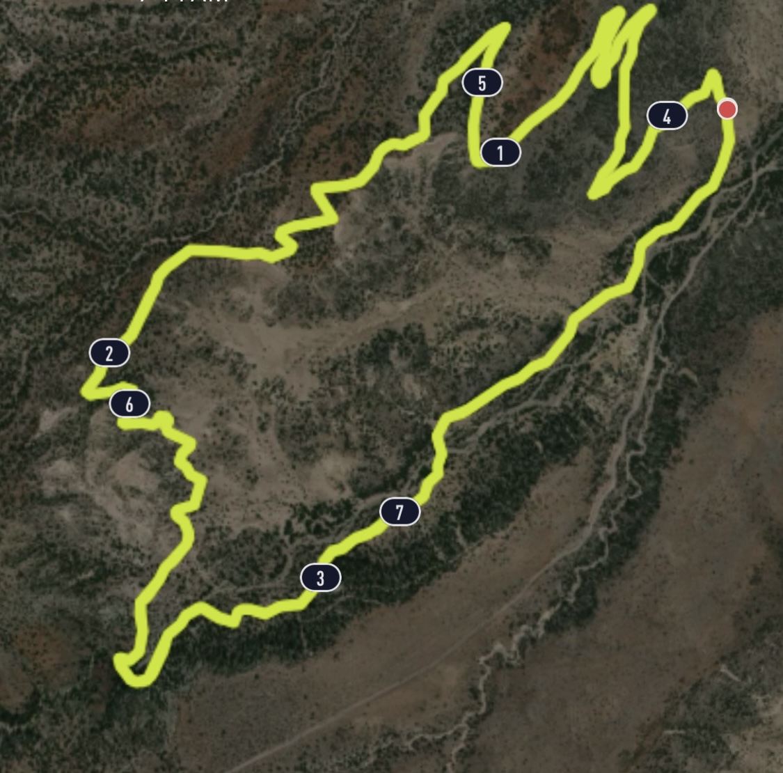
It’s the Copper Canyon Trail, a four-mile loop featuring switchbacks, stream crossings and (in winter and spring, a minor waterfall off the path) and I’m surprised every time I go there that it’s not more popular.
So let’s just let it be our little secret, OK?
The great thing about this trail — actually, there are several, but the most salient to travelers — is that it is short enough not to take up a big chunk of your time on your way to that thriving metropolis in the Valley. Runners can knock it out in about 30 minutes, 45 tops if you stop at the seasonal waterfall, and even the most dawdling hiker won’t need more than 1 hour, 10 minutes. I actually like doing two loops for a nice, even eight miles.
That’s not to say the Copper Canyon Loop is quick, easy and forgettable. You’ll climb 513 feet, about 300 of which comes in the first mile as you weave inexorably up a set of long switchbacks to the ridgeline. But it’s a subtle gain in elevation, nothing drastically steep. After one or two switchbacks, you’ll be somewhat surprised to look down and see how far away your car looks in the trailhead parking lot.
The fact that Camp Verde sits at 3,250 feet, as opposed to Flagstaff’s 7,000, goes a long way toward easing the burden of the climb, as well.

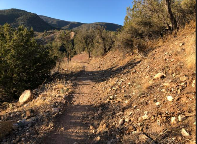
As for sights, don’t expect a lush ponderosa pine forest, like at home. Nor is that interesting blend of desert and mountain terrain, punctuated by the pretty red-rock geology, of Sedona up the road apiece. No, in Camp Verde, you have solidly entered a desert milieu, though not quite yet the blasted, sandy, saguaro landscape you’ll find farther south.
There are a variety of trees and shrubs, for one. For every yucca and cactus you dodge, you’ll pass by some junipers and scrub oak and even an occasional pinon pine, with leaves waving at you in the breeze. (By the way, it’s almost always windy on this trail.)
Also featured is something called the crucifixion-thorn plant, which looks like a mix between a tree and a shrub and is as spiny and spiky as its name implies. I once received a nasty gash on my right shin thanks to this freak foliage. At first, I thought the crucifixion-thorn were simply dead or neglected branches from some other, heartier bush – tumbleweeds in training, in other words. But, nope, these grey-barked wonders can grow as high as 10 feet.
Once you ascend to the ridge and get most of the climbing behind you, the singletrack trail flows and winds down the backside of the ridge before briefly climbing again. It is at this point when views of Interstate 17 appear. You can look at this eventuality one of two ways: either it’ll remind you that more than half of the slog to Phoenix still awaits you; or it’ll buoy your spirits that you found time to be virtuous and log exercise in the midst of commuting.
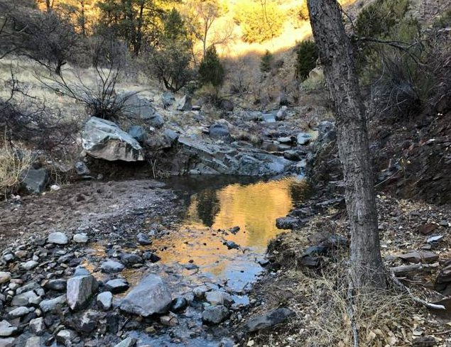
In any event, you aren’t subjected to the I-17 drone for too long. Instead, you are treated, about 2.5 miles into the loop, by a 0.2 of a mile side trail to Copper Falls, which only flows part of the year (like, right now) and should not be missed.
Let’s face it, it’s not the most impressive falls you’ve ever laid eyes on. Havasupai Falls, it definitely is not. But, hey, in a parched landscape, any flowing water is to be celebrated and gawked at. It takes just a wee bit of rock hopping to make it to the viewing spot, but it won’t tax your system or even get your shoes wet.
Back on the main trail, it’s an easy 1 ½-mile glide back to the trailhead. In fact, the entire trail is a glide. The path itself is extraordinarily smooth – only a few jutting rocks to impede your way – which is why mountain bikers and equestrian users also frequent it.
And the best thing is that, in an area where ATV trails outnumber all other paths, motorized vehicles are prohibited from the loop trail.
In no time, it seems, you’re back in your car, back on the road (after an obligatory stop at the Camp Verde Starbucks for rehydration) and headed to your destination.
Copper Canyon Loop, Camp Verde
Distance: 4 miles
Driving Directions: From Flagstaff, take Interstate 17 south for 55 miles to the General Crook Trail exit. Head east on General Crook to Highway 260. Turn right and go three-tenths of a mile and turn right on Oasis Road. After 0.3 of a mile, turn right onto FR 136. The trailhead is 0.8 of a mile away.
The Route: From the trailhead, start at the north-west corner. Look for the brown sign noting Trail 504. Head straight up the switchbacks to begin. At about 2.5 miles, you’ll reach a stream crossing, with a side trail to the west. That is the turn for the seasonal waterfall. Return to the main trail and follow it back to the trailhead.
Elevation Gain: 513 feet.


Leave a Reply