I have no beef with runners who like to gather in groups to tackle trails. Slightly off topic, but I’m curious: What’s the proper collective noun for runners? A Field of Runners? A Wheezing? A Strava? Some Brits, I learned via the web, use a “raggle of runners.”
Whatever.
Much of the time, though, I prefer solitude and like to run alone. In fact, I don’t even like to encounter fellow runners, even in passing, because then you have to decide whether to do that awkward wave and/or nod. It’s always disheartening when I wave and get nothing in return.
So, anyway, where can an introvert go? One such trail system that flies under the radar of most everyone, save off-road motorized vehicle aficionados, is the Kelly Trail System, beginning at the Fay Ridge Trailhead just off Lake May Road.
Yet, it occurs to me, that by writing about this 10-mile loop of singletrack, I may be encouraging people to congregate on this little-used trail, making it suddenly well-used and defeating the misanthropic ideal.
The Kelly Trails are about 26 miles worth of serpentine singletrack and fire roads that range from the hillsides around the airport to the north down nearly to the Munds Park forested area to the south, with valleys, meadows and forest stretching east toward Lake Mary.
It must be stated that these trails are open to and essentially were built for motorized vehicles. So if it’s anathema to you to have to step off the trail occasionally to let dirt-biker blow by, then the Kelly Trails aren’t for you. You never have to worry about waving to a dirt biker or four-by-four; they all are hell bent on speed and just zip by.
Now I consider myself something of a trail purist, in that I feel the best use of trails is on foot, leaving as little a footprint as possible to the delicate ecosystem. Despite that, I thoroughly enjoyed the 10-mile loop I ran on the Kelly Trails one recent morning.
One big reason: I had the trail to myself for the entire two hours I roamed and rambled.
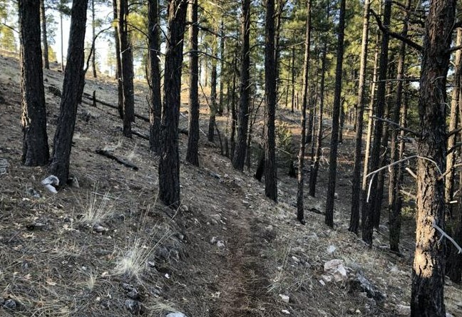
Yes, I saw no other human. Not another hiker. Not a mountain biker. Not a motorcyclist. No one. I did see a herd (or whatever the proper collective noun is) of deer prance by, which I actually welcomed. Other than that, it was a tranquil jaunt, replete with birds chirping, late spring butterflies fluttering and, only occasionally, the drone of a plane taking off from the airport.
Granted, part of the reason I was able to achieve solitude is that it was 7 a.m. on a weekday. But, I’m told, the Kelly Trails do not draw the consistently teeming crowds you might see at, say, Schultz Creek or Mount Elden.
That could be because there isn’t a lot of elevation gain, or that the forest isn’t as dense and lush as those around the peaks, or that in summer months there’s not a lot of shade, or that the distinct possibility of encountering motorized vehicles is a turn off.
All I can say is that I had a lovely, peaceful outing on the Kelly Trails. And you can, too, if you’re willing to go early and, perhaps, choose a weekday.
There is no caveat, though: If you don’t like technical singletrack — lots of rocks, lots of roots — you might want to pass on this one.
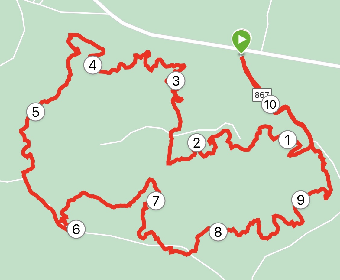
From the trailhead proper – you can also park right off Lake May Road and add 0.7 of a mile trot to the trailhead — you have the choice of going left or right. I went west, counter-clockwise, because the trail map showed that you have 4.9 miles on uninterrupted singletrack before hitting the first real junction with fire roads.
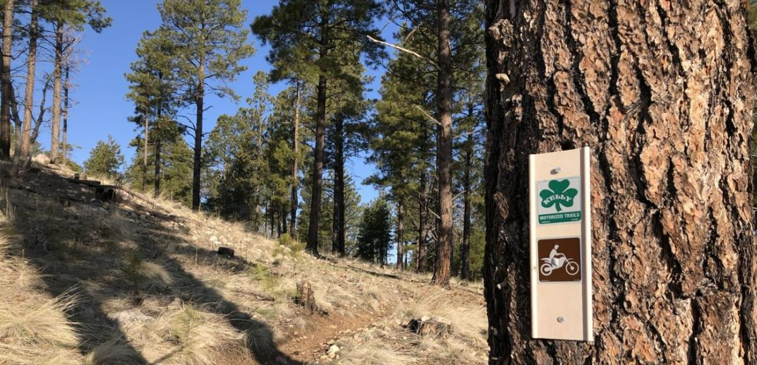
You lope about 0.1 of a mile on a fire road before the turnoff for the Kelly Trails appears on your right. Alerting you will be a sign featuring a bright green shamrock and another icon featuring a motorcycle rider. You’ll be seeing these signs a lot during the trek, leading you in the right direction. The course is marked well.
You immediately climb a slight ridge and wend your way through a series of wild and crazy turns, steadily climbing. The serpentine route adds a lot of mileage, but that’s the fun of it. Eventually, you reach the ridge top and go past a collection of downed trees and grassy meadows, before plunging back down into the ponderosas and up again.
The only real chance you have of getting lost comes about 2 miles in, when there’s a fork to a fire road on the left. A green Kelly shamrock points toward the fire road, but there also are other markers close by that point to the continuation of singletrack. A good rule of thumb: When faced with a choice, always pick the singletrack.
It was the right move. The shamrock markers picked up again, as you traversed some rocky and pine cone strewn trails. At one point in the first half of the run you parallel Lake Mary Road (above it, actually) before turning south once more toward the airport (which you, thankfully, never really see).
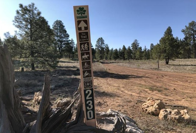
The second half begins once you descend into a valley with several fire roads to choose. For our purposes, head straight on a wide road marked 867A for a half mile. You might be tempted to veer immediately right onto the shamrock-labeled singletrack. That will lead to the southern part of the Kelly Trails, heading toward Munds Park (not our destination today).
Instead, after that half-mile, turn left onto a singletrack with the shamrock designation. It is there you will spend the next 4 miles winding through meadows and small stands of trees, crossing several fire roads, before circling back to the trailhead. Yeah, the rockiness returns, kind of a shock after that half-mile on the smooth forest road.
When I got back and was doing some post-run stretching, a clump of motocross dudes (is “clump” the proper collective noun?) was unpacking. I escaped just in time.
KELLY TRAILS
Distance: 10.9 miles (starting from Lake Mary Road); 9.2 miles (from the Fay Ridge Trailhead.
Driving directions: From Flagstaff, drive south/east on Lake Mary Road for about 3 miles. Look for the Fay Ridge Trailhead sign and turn right onto the fire road. Park at the Lake Mary Road pullout or, if the road is open, continue 0.7 of a mile the trailhead.
The route: From the trailhead, start counterclockwise (west) for 0.1 of a mile on a wide path. Turn right onto the shamrock-marked singletrack. Follow the singletrack for 4.9 miles until reaching a junction with several fire roads. Go straight on Road 867A for 0.5 of a mile, then turn left onto a singletrack marked with the shamrock. Follow the singletrack for about 4 miles back to the trailhead.
Elevation gain: 781 feet

Leave a Reply