Not that anyone, ahem, of a certain age doesn’t already know this, but it’s best for one’s emotional wellbeing not to scroll through past runs and compare the You of several years ago to the You of today. That way lies sadness.
Still, I couldn’t help myself.
I like running up O’Leary Peak for fun and fitness – five-mile climb with more than 2,000 feet of elevation gain, so what’s not to like? – but I made the mistake recently of remembering the first time I made the ascent (and, of course, descent) back in July of 2019.
Granted, I was old back then, too, but I truly believed that, five years hence and now a sexagenarian, I could run it faster now. After all, my first time on O’Leary, I had only lived in Flagstaff a month and was still feeling hypoxic running in our thin air. Plus, I’m 10 pounds lighter now than in 2019, so conceivably that would mean I could hoist my carcass up the mountain faster by not being “weighed down.”
Before making my first of what I hope will be several O‘Leary sojourns of 2024 last week, I purposely did not check my time from five years ago. I wanted to be pleasantly surprised, afterward, when I went back and checked just how much fitter I am now. I promised myself I would just do a steady pace, not maxxing out, the same as I did in 2019, to keep the comparison valid.
So, the result?
Eight minutes slower on May 1, 2024 than on July 20, 2019.
Ouch.
But I think I know why. It was the downhill. Comparing ascent times, it took me only 42 seconds longer this time than in 2019, but about a minute and a half slower going down per mile.
It was the jarring of my joints, the knees mostly, but the hips, too, that was my downfall. That, and the fact that, with my advanced age, comes the wisdom of not pushing myself on downhills in a non-race situation, lest I face plant or otherwise careen toward injury. My goal is to run into my 80s, so avoiding injury in my early 60s is prudent.
Sure, I was bummed by the evidence of my gradual, inexorable decline. And my wife, whose one of many degrees is in exercise science, correctly pointed out that my theory about weight-loss and speediness doesn’t work when you get older; you lose a chunk muscle mass every year in middle age, unless one strength trains like a demon.
Sorry. All of the above is just narcissistic navel (or Garmin) gazing on my part.
You, the reader, presumably want to know about the O’Leary Peak Trail itself.
Oh, yes, that.
There’s a reason the trail is popular with Flagstaff runners looking for some “easy” vert – easy, in this case, meaning without significant technical challenges such as rocks and roots. You follow the same forest road from the trailhead to the lookout tower as it winds serpentine-like, up the south side of the peak.
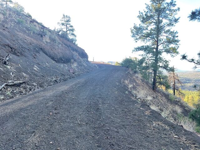
The path is mostly smooth with surprisingly little camber (or erosion). Only on the final push to the top does the road kind of dissolve into patches of scree.
As for the climb itself, I put O’Leary in the same category as climbing Mount Elden Road: lobster-in-a-pot hard. Meaning, the climb is relentless, but it eases you into it. By the time you get into a rhythm and got your breath under control, then the real climbing begins.
Actually, at the start, you headed slightly downhill (59 feet for the first mile), and off to the right was a large, jagged wall of blackened lava flow. It was close enough to the forest road that you could easily make a quick detour and climb the lava field.
For those trail purists who deride forest roads in favor of singletrack amidst lush vegetation, I say, deal with it. It’s not as if you were traversing a denuded environment along a dusty road. There were plenty of pines, aspens and spruce to satisfy your arboristic fix; they provided ample shade, too. You also get close up views of the damage wrought by the fire two years ago that briefly closed O’Leary, the singed trunks of pines a sober reminder.
But, yes, as you climbed — gaining 443, 427, 548 and 564 feet in miles 2 through 5, respectively — the trees thin and the sun beats down. (Even at 7 a.m. on May 1, it got a little warm running up the south-facing side.)
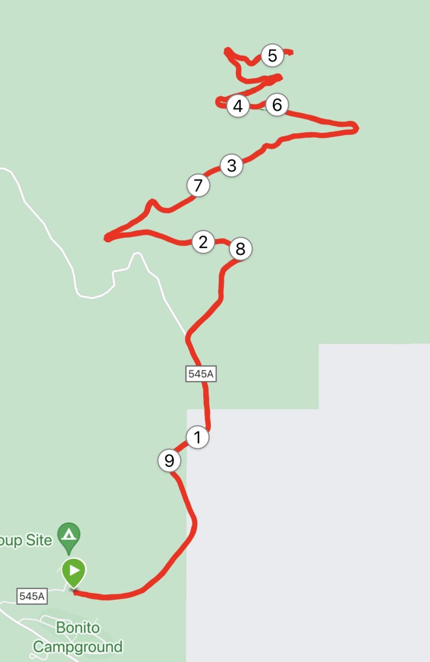
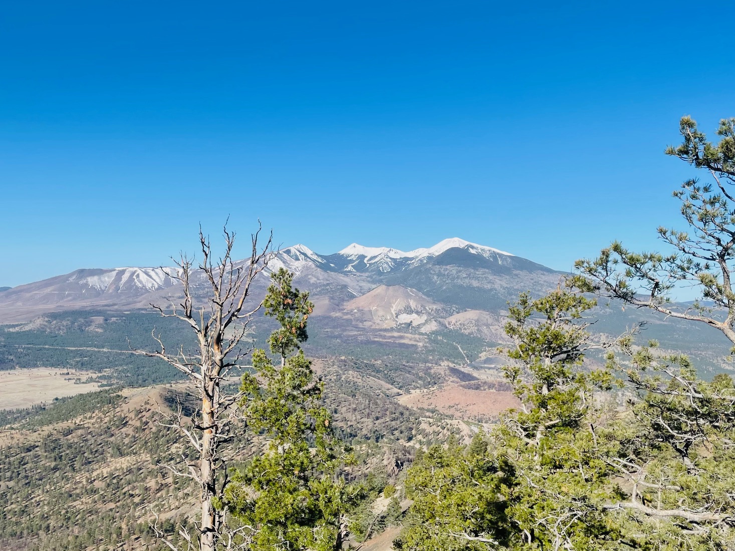
You have to bear down and work on form and arm swing and all that, but don’t be so singleminded in reaching the top that you don’t look around. But the views on the six switchbacks to the tower are enough to keep you going. About three miles in, there are panoramic glimpses of the lava fields you ran by earlier. Sunset Crater makes itself known, and, as you continue up, the Peaks come into full view.
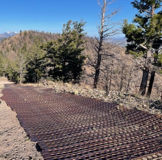
Once you reach the summit – at 8,911 feet, it’s slightly lower than the Elden Lookout – it’s time for mandatory vista viewing and dramatic landscape framing, all that Ansel Adams stuff.
I could clearly see the inner basin of the San Francisco Peaks and how it’s recovered from the fire, postcard-clear on this morning. I crouched between some foliage and trained the lens to the north where I was told you could see the north rim of the Grand Canyon. I scurried up some boulders south-east of the tower to zoom in on some overhead shots of the tiny (OK, only by comparison) Sunset Crater. But, alas, just like in 2019, the Painted Desert to the north-east was obscured by morning haze.
Instagram-worthy sights dutifully recorded, I was ready to begin the descent to the trailhead. The first mile back down the peak was by far my slowest of the trip, which slowed my overall time. It’s steep and not as well manicured as it is farther down on the road.
I’m blaming that for my slower-than-2019 time. Sure, it rankled that I ran slower, but I was still able to make the five-mile ascent in less than an hour, so I can take solace in that. But I know there will come a day when I’ll miss that mark.
Guess I’ll have to deal with it, but it’s hard for me, a guy who ages disgracefully.
O’Leary Outlook Trail
Length: 9.9 miles
Elevation gain: 2,083 feet.
Maximum elevation: 8,911 feet
Trailhead parking: From Flagstaff, take Highway 89 north and turn right on Forest Service Road 545 (look for a sign to Sunset Crater Volcano and Wupatki National Monuments). Go 1.7 miles and turn left on Road 545A. Park at the gate next to O’Leary Group Campground.
The route: Follow the fire road behind the gate for 4.9 miles to the lookout tower. There are no intersecting trails.

Leave a Reply