Please don’t dub me foolhardy, or environmentally insensitive, but two weeks ago I drove 24 miles just to run a five-mile trail. My carbon footprint on this day? Huge, massive, absolutely Sasquatch-sized.
Normally, I partake of trails closer to Flagstaff; lord knows, we have plenty. And when I occasionally do wander far afield, it’s usually for a big effort – much mileage, much grandeur, much fun.
But driving northwest for half an hour just to run for an hour? That might land a guy in climate-change jail.
Still, I had only been to Saddle Mountain, the nice little bump of a cinder cone northwest of Flagstaff off of Highway 180, once before, and that was clear back in pandemic times when people sought out remote locales to practice ambulatory heavy breathing without potentially infecting others.
The trip back recently, while short in duration, was long in pleasant trotting. And, both times, I haven’t run into a single soul on the trail – no runners, mountain bikers, equestrians, hikers, or even varmints – which is doubly pleasant for this inveterate introvert.
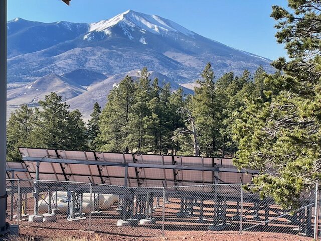
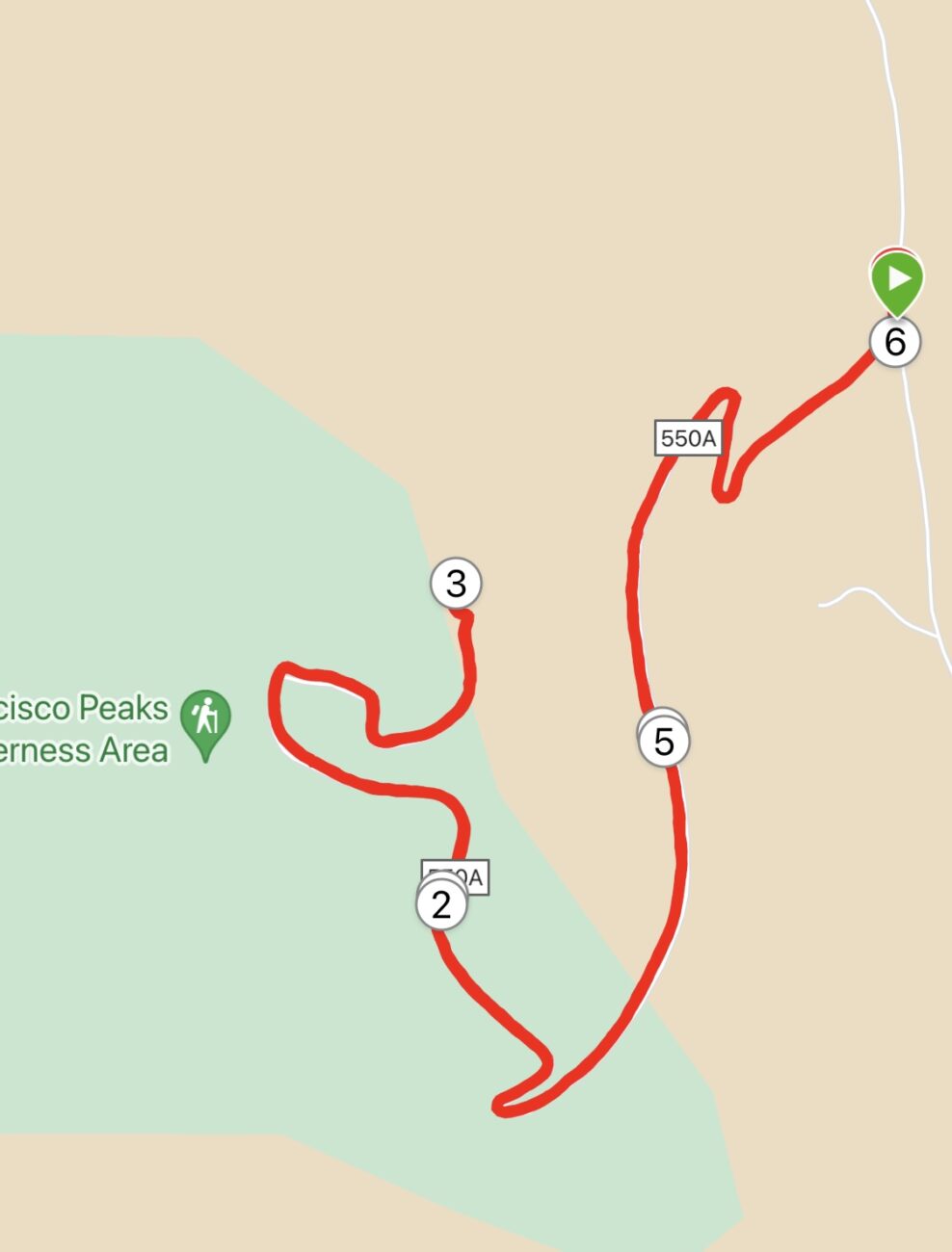
I’m not surprised I didn’t have to share the path, because until a couple of years ago, I had never heard of Saddle Mountain and the forest road (550A) winding three miles around it to the cell towers.
I first became aware of Saddle Mountain only after reading some Tweets by Matt McGrath (aka, “Ranger Matt”) of the Flagstaff Ranger District; he had scaled Saddle Mountain to get a better look at 2021 Slate Mountain fire. I don’t remember much about the fire, but I never forgot the Saddle Mountain shout out.
Another good sign for how obscure this trail remains: Few online trail reports exist for Saddle Mountain. On peakbagger.com, there were only three summit reports, all years old. Another site, listsofjon.com, ranks Saddle Mountain 126th in the state, based on height status (8,864 feet), not exactly a mountaineering challenge. Hiking maven Mare Czinar (arizonahiking.blogspot.com) wrote about Saddle Mountain back in 2012, but she mostly mentioned how it “gets lost in the fuss of more showy trails.”
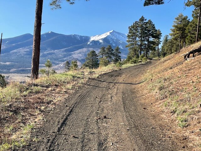
What makes people overlook Saddle Mountain is that it lacks a verdant singletrack path on the ascent; it’s just a three-mile forest road going up, up, up with little shade. But that forest road may be one of the smoothest in all the Coconino National Forest, making Woody Mountain Road seem like a rutted, jagged slog by comparison.
You may be doing nothing but climbing for the three miles to the cell towers — gaining 338 feet in Mile 1, 282 in Mile 2 and 308 in Mile 3 — but the firm yet soft and mostly even surface makes the steady ascent somewhat easier. And, on the descent, you can let loose without fear of face-planting after stumbling over a jutting root or rock.
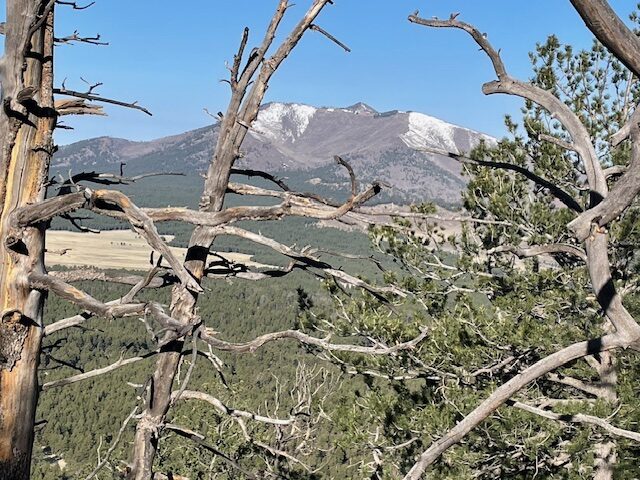
A few early blooms are evident, too, on the otherwise denuded cinder ridges along the forest road. But, primarily, you’ll want to climb Saddle Mountain for the views — not just at the top but on the exposed road wending around the south-eastern ridge, affording unobstructed gazing of the San Francisco Peaks and Kendrick Mountain, as well as the green expanse of the Kendrick Meadow hugging Highway 180 down below.
I was most eager to get to the top so I could gawk, like a traffic-accident rubbernecker, at the burn scar from the Slate Mountain Fire, which charred more than 11,000 acres on both sides of 180 three years ago. Good news: there’s already renewed growth in the scorched areas, the blackened parts looking like male-pattern baldness.
Best of all, I didn’t have to make awkward small talk with other people at the summit because, remember, not another soul was around — and no footprints either on the forest road, merely scattered cloven hoof prints.
My first time at Saddle Mountain, I did encounter some traffic on the way back to 180 and civilization. A quartet of grazing cows blocked FR 514. I inched along in my car, and three eventually ambled off. One stubborn bovine, a huge, black specimen nearly as big as my Subaru and branded on the side with “532” (his weight, perhaps), refused to budge. We had a standoff for maybe a minute, before it snorted and moved aside.
This time, though, even the cows were gone.
Ah, blissful solitude.
Saddle Mountain
Distance: 5.9 miles total (out-and-back)
Driving Directions: From Flagstaff, take Highway 180 (Fort Valley Road) for 19.7 miles to Forest Road 514, also called Kendrick Park Road. Turn right and go 2.5 miles to FR 550 and turn left. Go 1.9 miles. Park at the pullout at the intersection with FR 550A.
The Route: Take FR 550A, a wide and smooth path, up nearly three miles to the summit cell towers. Retrace steps back to the intersection with FR 550.
Elevation gain: 965 feet
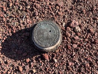
Highest Elevation: 8,864 feet
Leave a Reply