I wanted to write about my indecisiveness when it comes to choosing the type of surface on which to run, but I just couldn’t bring myself to pull the trigger and select which of the options – road, technical trail, forest road, singletrack – to highlight.
It’s almost as bad as my prolonged decision-making and constant waffling (hmm, waffles?) on what to eat for dinner.
But back to running and choosing courses, the topic at hand.
So, the other day, I was torn on which surface to pick for my long run.
Lake Mary Road? Not really up for 13 miles of asphalt.
Forest Roads? Meh, I’d done Wing Mountain two days before and Woody Mountain/FR 532 the day before that.
Technical? A possibility, because I didn’t care about going fast, but which one of the surfeit of choices?
Singletrack? See above.
What I needed was a little bit of everything, a long-run buffet in which I could pick and choose options, mix things up so as to stave off boredom on a Sunday morning. I exhumed my trusty “Emmitt Barks Cartography Flagstaff Trail Map” from deep in my desk drawer and started perusing.
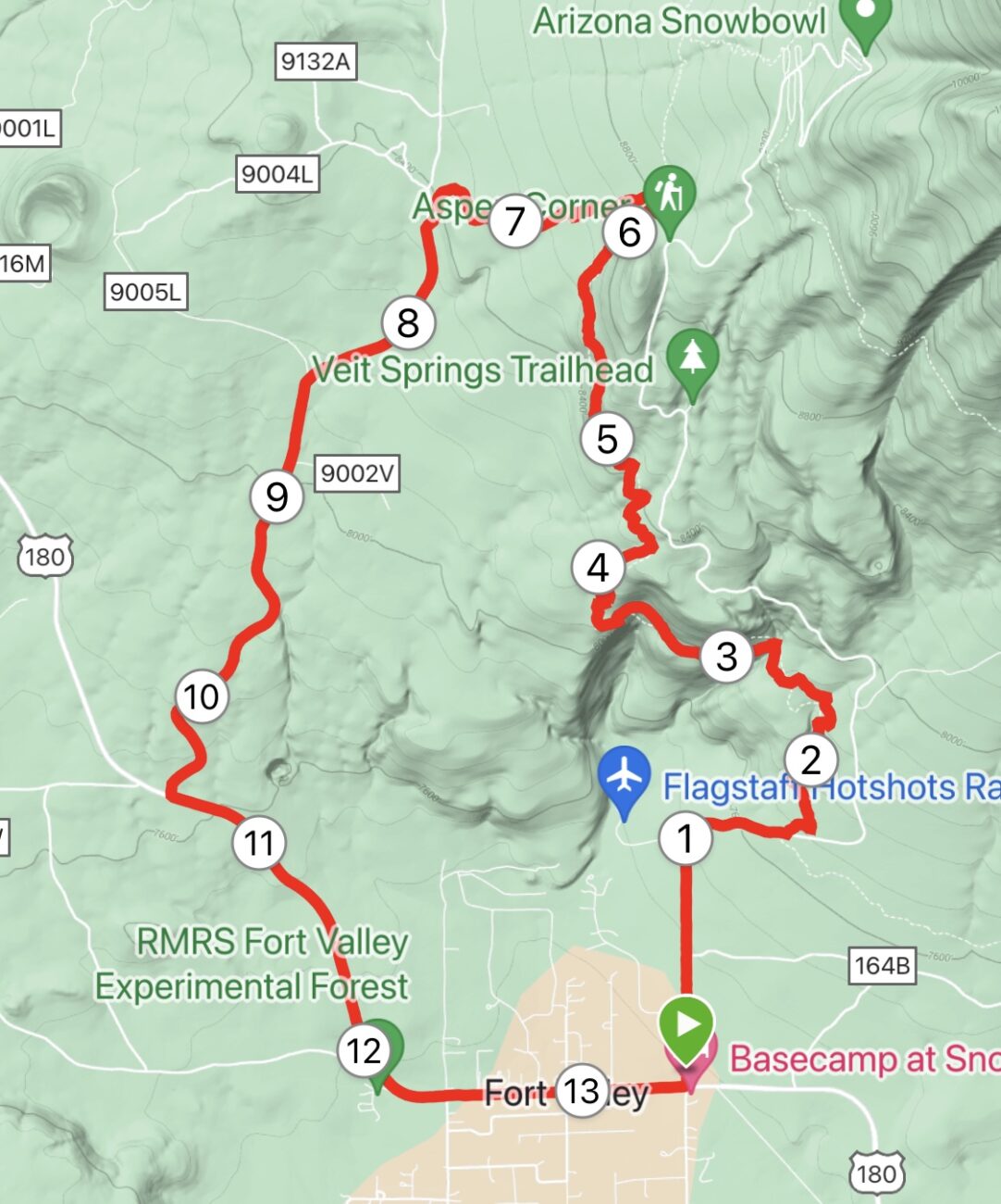
Here’s the course I devised, a smorgasbord of surfaces:
Park in the lot at the corner of Highway 180 and Snow Bowl Road. Head north (slightly uphill) on the paved road for 1.5 miles, making that first righthand turn before the real climbing begins. Turn left on the Arizona Trail (Section 34b) and spend the next 4.5 miles traversing technical singletrack until you reach Aspen Corner. At the junction, turn left on the unnamed trail, rocky and singletrack, that passes Alfa Fia Tank for about 1.3 miles. When you reach Hart Prairie Road (FR 151), turn left and head downhill for 3 miles to the junction with Highway 180. Cruise on the shoulder of 180 for 2.5 miles to complete the loop at Snow Bowl.
All told, it’s 13.4 miles.
I know that your first question might be: what shoes do I wear doing this run.
Gosh, doesn’t everybody own a special pair of hybrid road-rock-singletrack-forest road shoes?
My choice was a nimble pair of trail shoes that could both absorb the rocks and roots on the Arizona Trail and Alfa Fia segments, stiff but not overly so, and give some spring on the smoother forest road and asphalt segments.
Lately, my go-to shoe for all trail surfaces has been the Adidas Agravic Speed Ultra model – firm, supportive but supple and with some pop. And, no, I’m not plugging the brand and I didn’t get a free pair or anything (I wish; if anything, I’m a disinfluencer). Really, any of the speedier trail shoes on the market will do, say, the Hoka Tecton X 2.
Another question you may be asking: Is it an enjoyable run?
Well, yes. Most of it.
The first 1.5 miles on the paved Snow Bowl Road, slightly uphill (171 feet the first mile) is not exactly blissful, but it gets the body warmed up and ready to tackle the AZT. One side note: It may be time, during the off-season from skiing, for officials to repave Snow Bowl Road; that first 1.5 miles is riddled with San Andreas Fault-sized cracks in the pavement.
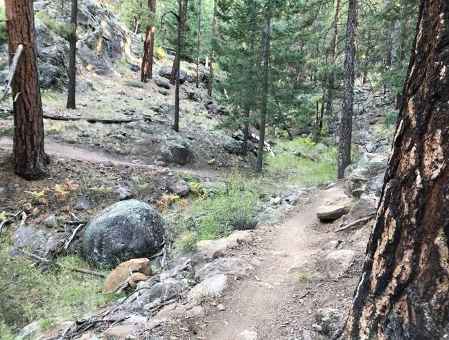
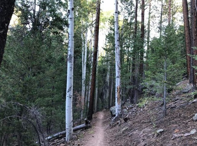
Next comes the AZT Segment 34b. I’ve run this stretch of the trail often, but I always forget how rocky and root-laden it gets in the last mile or so before the junction at Aspen Corner. The good thing about the segment is that it’s entirely runnable and not as steep as I remembered it in retrospect. You can hear some vehicle traffic at the start of the trail, but soon civilization fades and you find yourself traversing a winding path through the forest, dappled sunlight suffusing things with a warm glow. As you ascend the ridge, be sure to look to your left and take in Fort Valley and Baderville below. But the main views on this route are not panoramic vistas; rather, it’s the chance to rub shoulders with mature pines and scattered aspens.
Every time I run this section – a 1,339 elevation gain to just shy of 9,000 feet – I think about the brave souls (and soles) who each September run the Flagstaff to Grand Canyon Stagecoach Line 100 Mile and 55K. They have to make this climb at the start of that long race – though it does flat out and even go a little downhill north of Humphries peak.
You are mostly done with the climbing once you hit Aspen Corner, but the first, downhill part of unnamed trail heading through the Hart Prairie meadow is scree scarred. Eventually, around Alfa Fia tank, you pick up some singletrack that resembles a real trail. The meadow was lovely on a late June morning, with green ferns knee-high with a little dew and the sun at your back. Many times, deer frolic and feast on the grasses but, alas, not this morning.
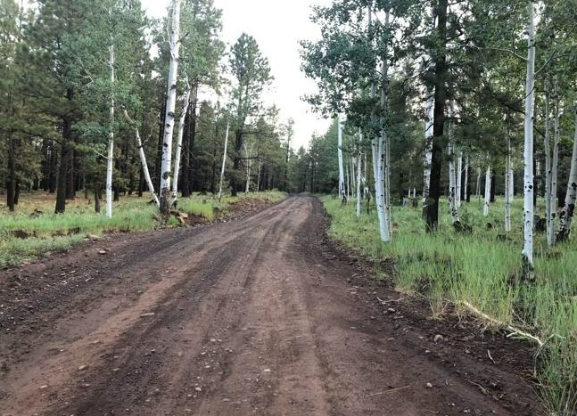
After the fence line and a gate, it’s just a short jaunt to Hart Prairie Road. Make sure to turn left (south) heading downhill, unless you want to keep on the Stagecoach Line race route.
On this morning, having completed a heavy mileage week before this, I enjoyed Hart Prairie. The dirt road was hardpacked and mostly smooth, and you could really open up and get some good turnover after having to watch each footfall on the AZT. It helps that you lose 716 feet, but it never is a steep descent, just a gradual, flowing glide.
There is even more downhill on the winding, 2.5-mile finishing segment on Highway 180, but there is no bike lane running against traffic. However, for parts of it, there’s a narrow cinder/dirt soft shoulder. But watch out for speeding cars hellbent on making good time to get to the Grand Canyon.
I’m not saying this is a run I’ll do often, but there is a lot of variety. My legs did not feel as thrashed as if I’d done 13 miles of technical trail running, and I wasn’t bored running an out-and-back on asphalt. Just a little taste of AZT climbing was enough for me on this day.
Snow Bowl Road/AZT Segment 34b/Hart Prairie FR 151/Highway 180
Distance: 13.4 miles
Driving Directions: Park at the paved lot on the northwest corner of Snow Boal Road and Highway 180.
The Route: Go north on Snow Bowl Road for 1.5 miles. Turn left onto the signed AZT and go 4.5 miles to Aspen Corner. Turn left at the junction sign and descend into Hart Prairie and Alfa Fia Tank. After 1.3 miles, you reach a fence line and gate. Cross and pick up Hart Prairie Road (FR 151). Go about 3 miles. Turn left on Highway 180 and return to the Snow Bowl/180 parking lot.
Elevation Gain: 1,614 feet.

Leave a Reply